Wapack Trail
| Wapack Trail | |
|---|---|
|
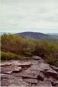
View from Pack Monadnock on Wapack Trail | |
| Length | 21 mi (34 km) |
| Location | Worcester County, Massachusetts and Hillsborough County, New Hampshire |
| Use | hiking, snowshoeing, cross-country skiing, other |
| Elevation | |
| Highest point | Pack Monadnock, 2,288 ft (697 m) |
| Lowest point | Spofford Gap, 1,226 ft (374 m) |
| Hiking details | |
| Trail difficulty | easy, with moderately difficult sections |
| Season | easiest mid-spring to mid-fall |
| Hazards | deer ticks, weather, poison ivy |
The Wapack Trail is one of the oldest public, interstate hiking trails in the United States. Opened in 1923,[1] it follows the Wapack Range north-south for 21 miles (34 km), between Mount Watatic in Ashburnham, Massachusetts and North Pack Monadnock mountain in Greenfield, New Hampshire. It is designed primarily for day use by hikers, with minimal camping facilities.
The trail passes through the Massachusetts towns of Ashburnham and Ashby, and the New Hampshire towns of New Ipswich, Temple, Sharon, Peterborough, and Greenfield. It also goes over Temple Mountain, and through Miller State Park and the Wapack National Wildlife Refuge, as well as numerous privately owned parcels of land.
The trail is overseen by Friends of the Wapack, a non-profit group.[2] Aside from upgrading and maintaining the trail, the group is trying to have the entire length preserved from development.
The southern part of the Wapack Trail overlaps with the northern part of the Midstate Trail.

History
The trail was born in a conversation in the summer of 1922 at the Shattuck Inn in Jaffrey, New Hampshire between Allen Chamberlain, who later became president of the Appalachian Mountain Club, and Jaffrey farmer Albert Annett while overlooking the Wapack Range, then known as the Boundary Mountains. The two talked about the possibility of a skyline trail along the ridge of the Boundary Mountains from Mt. Watatic to North Pack Monadnock. Later, Albert brought the idea to fellow farmers Frank Robbins and Marion Buck of Rindge, New Hampshire. The three started cutting the trail near the end of the summer using hand tools. The trail was opened in 1923. Buck named it by joining the Wa from Mt. Watatic and Pack from North Pack Monadnock, and soon the Boundary Mountains became known as the Wapack Range.
Trail running races
There are two races on the trail. A race in May[3] organized by Trail Animals Running Club has a 21.5-mile (34.6 km) version which goes the whole length of the trail beginning at the northern terminus and a longer, 50-mile (80 km) out-and-back ultramarathon beginning at the southern terminus. A Labor Day 18-mile (29 km) race[4] covers the southern part of the trail from the Windblown cross-country ski area[5] to Mount Watatic and back.
External links
Coordinates: 42°48′54″N 71°53′30″W / 42.81500°N 71.89167°W