Wayllani
For the mountain in the La Paz Department, Bolivia, see Wayllani (La Paz).
| Wayllani | |
|---|---|
 Wayllani Location in Bolivia | |
| Highest point | |
| Elevation | 4,206 m (13,799 ft) [1] |
| Coordinates | 17°58′42″S 66°54′24″W / 17.97833°S 66.90667°WCoordinates: 17°58′42″S 66°54′24″W / 17.97833°S 66.90667°W |
| Geography | |
| Location |
Bolivia, Oruro Department |
| Parent range | Andes |
Wayllani (Aymara waylla Stipa obtusa, a kind of feather grass,[2][3] -ni a suffix, "the one with the feather grass", also spelled Huayllani) is a 4,206 m (13,799 ft) high mountain in the Andes in Bolivia. It is located in the Oruro Department, Cercado Province, Paria Municipality (formerly Soracachi). Wayllani lies east of Jach'a Ch'ankha and southeast of Chunkara.[1][4]
References
- 1 2 Bolivian IGM map 1:50,000 Thola Palca 6240-III
- ↑ Plan de desarollo municipal Municipio de Turco (Spanish)
- ↑ Radio San Gabriel, "Instituto Radiofonico de Promoción Aymara" (IRPA) 1993, Republicado por Instituto de las Lenguas y Literaturas Andinas-Amazónicas (ILLLA-A) 2011, Transcripción del Vocabulario de la Lengua Aymara, P. Ludovico Bertonio 1612 (Spanish-Aymara-Aymara-Spanish dictionary)
- ↑ "Soracachi". INE, Bolivia. Retrieved March 22, 2016.
Capital: Oruro | ||
| Provinces | 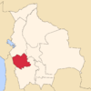 | |
| Municipalities (and seats) |
| |
This article is issued from Wikipedia - version of the 3/22/2016. The text is available under the Creative Commons Attribution/Share Alike but additional terms may apply for the media files.