Weener
| Weener | ||
|---|---|---|
| ||
 Weener | ||
Location of Weener within Leer district 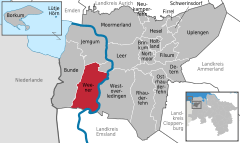
 | ||
| Coordinates: 53°10′09″N 07°21′23″E / 53.16917°N 7.35639°ECoordinates: 53°10′09″N 07°21′23″E / 53.16917°N 7.35639°E | ||
| Country | Germany | |
| State | Lower Saxony | |
| District | Leer | |
| Government | ||
| • Mayor | Wilhelm Dreesmann (Ind.) | |
| Area | ||
| • Total | 81.24 km2 (31.37 sq mi) | |
| Population (2015-12-31)[1] | ||
| • Total | 15,510 | |
| • Density | 190/km2 (490/sq mi) | |
| Time zone | CET/CEST (UTC+1/+2) | |
| Postal codes | 26826 | |
| Dialling codes | 04951 | |
| Vehicle registration | LER | |
| Website | www.weener.de | |

Weener (German pronunciation: [ˈveːnɐ]) is a town in the district of Leer, in Lower Saxony, Germany. It is situated near the border with the Netherlands, on the river Ems, approx. 10 km southwest of Leer, and 25 km southeast of Emden. Near Diele, there is a 380 kV-substation, where since 2009 HVDC BorWin1, the first HVDC running to an offshore windpark in Germany runs.
The city was first mentioned in a monastery's records in 951.
South of Weener, there is the 380kV-Ems-Overhead Powerline Crossing.
Town
Division of the town
The town of Weener consists of 9 districts:
- Weener
- Kirchborgum
- Diele
- Vellage / Halte
- Stapelmoor
- Holthusen
- Weenermoor / Möhlenwarf
- St. Georgiwold
- Beschotenweg
Neighbouring communities
In the district of Leer:
In the district of Emsland:
Politics
Mayor
Wilhelm Dreesmann has been the mayor of Weener since Nov. 1, 2006. He won 51.9% of the votes.
Town Council
The last election to the town council took place in 2006:
- SPD = 53,0%, 17 seats
- CDU = 19,6%, 6 seats
- UWG = 19,0%, 6 seats
- Grüne = 5,6%, 2 seats
- FDP = 1,9%, 1 seat
Two members of the SPD group have split and form a single group in the council today.
International relations
Weener is twinned with:=
Demographics
Always on December, 31.
- 1980 - 14.115
- 1985 - 14.245
- 1990 - 14.320
- 1995 - 14.831
- 2000 - 15.338
- 2001 - 15.406
- 2002 - 15.534
- 2003 - 15.625
- 2004 - 15.666
- 2005 - 15.602
References
External links
- Official site (German)
Towns and municipalities in Leer (district) | ||
|---|---|---|