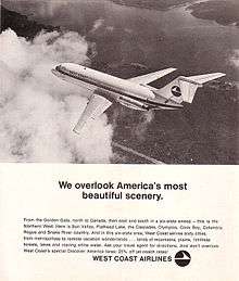
West Coast Airlines Flight 956
| Accident summary | |
|---|---|
| Date | October 1, 1966 |
| Summary | Controlled flight into terrain |
| Site |
Clackamas County, 5.5 miles (8.9 km) south of Wemme, Oregon 45°15′35″N 121°59′43″W / 45.259617°N 121.995233°WCoordinates: 45°15′35″N 121°59′43″W / 45.259617°N 121.995233°W[1] |
| Passengers | 13 |
| Crew | 5 |
| Fatalities | 18 |
| Survivors | 0 |
| Aircraft type | Douglas DC-9-14 |
| Operator | West Coast Airlines |
| Registration | N9101 |
| Flight origin | Eugene Airport, Eugene, Oregon |
| Destination | Portland International Airport, Portland, Oregon |
West Coast Airlines Flight 956 was a scheduled commercial flight which crashed on October 1, 1966, approximately 5.5 miles (8.9 km) south of Wemme, Oregon, United States. Thirteen passengers and five crew members were aboard, and there were no survivors. The aircraft was destroyed by the impact and subsequent fire. The probable cause of the accident was "the descent of the aircraft below its clearance limit and below that of surrounding obstructing terrain, but the Board was unable to determine the cause of such descent."[2] This accident was the first loss of a Douglas DC-9.[3]
History
On October 1, 1966, a Douglas DC-9 registered in the United States as N9101 operated as Flight 941 from Seattle, Washington to San Francisco, California with intermediate stops in Portland and Eugene. After approximately one hour on the ground, the aircraft and crew became Flight 956, which reversed the route and stops of the previous flight. Flight 956 arrived in Eugene at 19:34 and departed for Portland at 19:52. The flight received an Instrument Flight Rules (IFR) clearance via Victor Airway 23 at 12,000 feet (3,700 m) altitude.[2]
Accident
Under Air Traffic Control radar vector at 20:04:25, Flight 956 received descent instructions from Seattle Center. Flight 956 acknowledged the transmission to descend to 9,000 feet (2,700 m) from 14,000 feet (4,300 m). Approximately one minute later, the controller advised the flight that Runway 28R was in use at Portland International Airport and instructed the flight to "turn right heading three zero zero." After questioning the direction of the turn, the crew acknowledged "Right turn to three zero zero, roger." The controller lost radar contact with the flight while it was in the right turn passing through an estimated heading of 240-260 degrees. At 20:09:09 the crew was requested to report when established on a heading of 300 degrees. After repeating the request, the crew responded at 20:09:27 "Nine five six wilco." When the radar target failed to return, and no other transmissions were heard from the flight, accident notification procedures were initiated at 20:15.[2] An F-106 aircraft from McChord Air Force Base east of Tacoma, Washington and a HU-16 Albatross from Portland's air base were dispatched to attempt to locate the missing plane on the night it disappeared.[4] At the time of the disappearance, the flight ceiling was at 2,900 feet, with the weather consisting of rain.[4]
Wreckage
Searchers found the plane the following afternoon.[5] The aircraft crashed in an unpopulated section of the Mount Hood National Forest. The wreckage is located on the eastern slope of a 4,090 feet (1,250 m) ridge in the Salmon Mountain Complex at an elevation of 3,830 feet (1,170 m).[6] The aircraft attitude was 30 degrees right bank, in a 3-4 degree climbing flightpath on a heading of 265 degrees at impact. After shearing numerous large fir trees, it struck the 30-35 degree upslope and slid uphill approximately 150 feet (46 m). The main wreckage came to rest at an elevation of 3,890 feet (1,190 m), and a severe ground fire occurred.
All of the extremities of the aircraft were accounted for, and no evidence of in-flight structural failure, fire, or explosion was found. The aircraft was equipped with a flight data recorder and a cockpit voice recorder. Although both were recovered from the wreckage, only the flight data recorder provided a usable record.[2] William L. Lamb of the Civil Aeronautics Board was in charge of the investigation.[4]
Aircraft information

N9101, a Douglas DC-9-14, serial number 45794, was purchased new by West Coast Airlines on September 16, 1966, just 15 days prior to the accident. The plane had entered service on Monday, September 26, 1966.[5] At the time of the accident, N9101 had flown a total of 164 hours ten minutes and had been maintained as required by the Federal Aviation Administration.[2] The cost of the 75-passenger plane was $3 million.[5]
Findings
The specific cause of the accident was never determined by the National Transportation Safety Board. However, in the process of the investigation, the NTSB made these findings:
- The aircraft was airworthy and the pilots were properly certified.
- There was no mechanical failure of the aircraft, its systems, powerplants or components.
- The flight was cleared to, and acknowledged, an assigned altitude of 9,000 feet.
- The aircraft was being flown on autopilot.
- The flight descended in a normal manner to approximately 4,000 feet and leveled off.
- An abrupt climb was initiated two seconds before impact.
See also
References
- ↑ Per GPS at debris field. The coordinates given in official NTSB report are: 45°51′21″N 121°59′36″W / 45.85583°N 121.99333°W.
- 1 2 3 4 5 Aircraft Accident Report. West Coast Airlines, Inc DC-9 N9101. Near Wemme, Oregon, Adopted: December 11, 1967
- ↑ Airliners Historical Overviews/Aircraft Specifications/Crash Statistics
- 1 2 3 Airliner missing with 20 on coast: DC-9 Feared Down in Area Near Oregon Mountain. The New York Times, October 2, 1966.
- 1 2 3 All 18 on Plane Killed in Oregon Crash. The New York Times, October 3, 1966.
- ↑ Air Force Coordination Center Crash Locator