Westrich Plateau

The Westrich Plateau (German: Westricher Hochfläche),[1] also Zweibrücken Westrich (Zweibrücker Westrich)[2] or Southwest Palatine Plateau (Südwestpfälzische Hochfläche),[3][4][5] is a landscape in the German state of Rhineland-Palatinate, with small areas also in the Saarland (Saarpfalz-Kreis). Its heart is in the southwest of the Palatinate region and it is part of the historic region of Westrich.[6]
Geography
Structure and boundaries
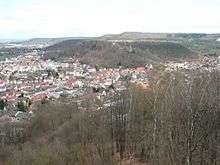
The Westrich Plateau consists mainly of the Sickingen Heights in the north and the Zweibrücken Hills in the south which, morphologically, belong more to northeastern Lorraine in France).[7]
The main plateau falls away in a marked scarp slope, the Sickingen Escarpment, to the northwest (towards the Homburg Basin) and especially to the north, towards the Landstuhl Fault. By contrast, the eastern edge of the Westrich transitions rather smoothly from its muschelkalk plateau to the bunter sandstone of the Palatine Forest. The subdivisions of the plateau along the Moosalb and near Eppenbrunn also extend into the wooded region of the Palatine Forest Nature Park. In the east the land gradually descends to the settlement fringe of Pirmasens and the Trualbe, opposite the Queidersbach and the Moosalb valley, which forms the actual eastern boundary.[8] To the south the Zweibrücken Hills continue the plateau into France.
The central section of the plateau's western boundary with the Saint Ingbert-Kirkeler Woods and, further south, with the Bliesgau, runs (according to the Bundesanstalt für Landeskunde, Saarbrücken sheet, and popular opinion) just west of the state border with Saarland and does not cross the valley of the Blies, which from here on forms the boundary with the first-named of the two regions. This compares with a purely Saarland division according to Quasten which also counts a narrow strip of land southwest of Blieskastel (right = west of the Blies) as part of the Zweibrücken Westrich.[9]
References
- ↑ Helmut Beeger et al.: Die Landschaften von Rheinhessen-Pfalz − Benennung und räumliche Abgrenzung. In : Berichte zur deutschen Landeskunde, Vol. 63, Part 2, Trier, 1989, pp. 327–359
- ↑ For example in the Handbuch der naturräumlichen Gliederung Deutschlands.
- ↑ Albert Zink (1966) (in German), Die Pfalz, mein Heimatland : Eine Heimatkunde für die Pfälzer Jugend (3. ed.), Speyer: Zechner
- ↑ Heinz Wittner: Großer Pfalzführer, p. 479
- ↑ Emil Heuser: Neuer Pfalzführer, p. 6
- ↑ August Becker: Die Pfalz und die Pfälzer, pp. 347−354; pp. 363−368; pp. 369−385
- ↑ Michael Geiger: Die Landschaften der Pfalz, pp. 102 − 103
- ↑ Helmut Beeger u. a.: Die Landschaften von Rheinhessen-Pfalz − Benennung und räumliche Abgrenzung. In : Berichte zur deutschen Landeskunde, Vol. 63, Heft 2, Trier, 1989, pp. 336–338
- ↑ Systeme Schneider/Werle (Blätter Saarbrücken und Trier/Mettendorf) vs Quasten auf einer Karte (pdf, 2.0 MB)
Literature
- August Becker (2005 (1st edn., 1857)) (in German), Die Pfalz und die Pfälzer (7. ed.), Landau/Pfalz: Pfälzische Verlagsanstalt, pp. 338–363, ISBN 3898571939
- Michael Geiger (2010), Michael Geiger, ed., "Die Landschaften der Pfalz" (in German), Geographie der Pfalz (Landau/Pfalz: Verlag Pfälzische Landeskunde): pp. 92–113, ISBN 9783981297409
- Daniel Häberle (1913) (in German), Der Pfälzerwald : Ein Beitrag zur Landeskunde der Rheinpfalz, Braunschweig und Berlin: Georg Westermann Verlag
- Karl Heinz (1976, ASIN B002GZ8RN) (in German), Pfalz mit Weinstraße : Landschaft, Geschichte, Kultur, Kunst, Volkstum, Heroldsberg: Glock und Lutz Verlag, pp. 239-268
- Emil Heuser (1979 (1st edn., 1900), ASIN B0043G3V6M) (in German), Neuer Pfalzführer (14th ed.), Ludwigshafen/Rhein: Waldkirch Verlag
- Heinz Wittner (1981) (in German), Großer Pfalzführer, Stuttgart: Deutscher Wanderverlag Dr. Mair & Schnabel & Co., pp. 479–510, ISBN 3813401065
External links
- BfN landscape fact file