Wet Mountain Valley


The Wet Mountain Valley is a high elevation mountain valley located in Custer County, in south-central Colorado.
Geography
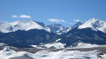
The Wet Mountain Valley is nestled beneath the biologically diverse Wet Mountains on the east, and the rugged Sangre de Cristo Range that parallels the valley on the west. Both mountain ranges are in the Sangre de Cristo Mountains System of the Southern Rocky Mountains.
The towns in the valley are Westcliffe and Silver Cliff, which are at an elevation of just under 8,000 feet (2,400 m). The area is known for its historical ranches and excellent hay production.
The valley is drained by two major drainages: Grape Creek which begins in the south of Custer County near Music Pass and flows North into Deweese Reservoir from there it enters a narrow gorge before reaching the Arkansas River, and Texas Creek which begins northwest of Westcliffe and flows to the northeast meeting the Arkansas River at US Highway 50.
References
External links
- "Wet Mountain Valley". Geographic Names Information System. United States Geological Survey. Retrieved 2013-12-24.
Coordinates: 38°04′00″N 105°26′32″W / 38.06666667°N 105.44222222°W