Whale Lake
| Whale Lake | |
|---|---|
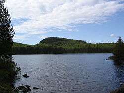 Whale Lake on a summer evening. | |
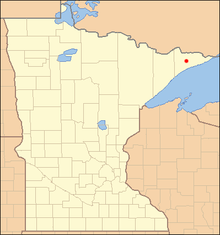
| Location | West Cook, Cook County, Minnesota, United States |
| Coordinates | 47°53′31.19″N 90°32′43.37″W / 47.8919972°N 90.5453806°WCoordinates: 47°53′31.19″N 90°32′43.37″W / 47.8919972°N 90.5453806°W |
| Primary outflows | Whale Creek |
| Basin countries | United States |
| Surface area | 21 acres (8.5 ha) |
| Max. depth | 10 ft (3.0 m) |
| Surface elevation | 1,900 feet (580 m) |
| Settlements |
Grand Marais, Minnesota Cook, Minnesota |
Whale Lake is a lake in Cook County in what is known as the Arrowhead Region of northern Minnesota. It is within the Boundary Waters Canoe Area Wilderness of the Superior National Forest, at the base of Eagle Mountain, Minnesota's highest point. Two miles (3 km) from the nearest road, Whale Lake is only accessible via the Eagle Mountain Hiking Trail from the south, or the Brule Lake Trail from the northwest.[1] It offers two campsites to hikers, one on the northern shore near the intersection of the two trails, and the other a few hundred yards away from the western shore.
Whale Lake has been known to contain Bluegill,[2] Northern Pike, [3] Yellow Perch,[3] and more commonly, White Sucker fish.[3]
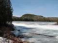 Whale Lake, on an early Spring day
 Looking southeast over Whale Lake
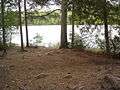 Looking south across Whale Lake. Campsite in the foreground.
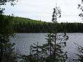 Looking southwest across Whale Lake
External links
| Wikimedia Commons has media related to Whale Lake, Minnesota. |
References
- ↑ Trails of the BWCA, Kekabic Trail Club Maps, The Hungry Beaver, May, June, July, 1996.
- ↑ "Whale Lake details". lake-link.com. 2007. Retrieved 2007-09-06.
- 1 2 3 "Whale Lake Information Report". Lakefinder. Minnesota Department of Natural Resources. 1973-08-27. Retrieved 2007-09-06.
This article is issued from Wikipedia - version of the 10/26/2016. The text is available under the Creative Commons Attribution/Share Alike but additional terms may apply for the media files.