Wila Pukarani
| Wila Pukarani | |
|---|---|
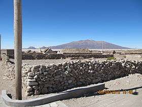 Wila Pukarani as seen from Witalina | |
| Highest point | |
| Elevation | 4,920 m (16,140 ft) [1] |
| Coordinates | 19°19′50″S 68°18′35″W / 19.33056°S 68.30972°WCoordinates: 19°19′50″S 68°18′35″W / 19.33056°S 68.30972°W [2] |
| Geography | |
 Wila Pukarani Bolivia | |
| Location | Bolivia, Oruro Department, Sabaya Province, Coipasa Municipality |
| Parent range | Andes |
Wila Pukarani (Aymara wila red or blood,[3] pukara pucará (fortress) or mountain of protection,[4] -ni Aymara suffix to indicate ownership, "the one with a red pukara", hispanicized spellings Vila Pucarani / Villa Pucarani) is a volcano located in the Coipasa salt pan in the Bolivian Altiplano. It is approximately 4,920 m high reaching a prominence of at least 1,200 m. It is situated in the Oruro Department, Sabaya Province, Coipasa Municipality.[5]

Wila Pukarani surrounded by Coipasa salt pan
See also
References
- ↑ wikimapia.org
- ↑ wikimapia.org
- ↑ katari.org Aymara-Spanish dictionary: Wila (s.) - Sangre. adj. Color rojo.
- ↑ portal.perueduca.edu.pe Yatiqirinaka Aru Pirwa (Aymara-Spanish Dictionary): Pukara (s). 1. Jach’a qalanakampi lawkata pirqata chiqawa. - Fortaleza. 2. Jach’a sayt’u munañani qullunaka, jaqinakana yupaychäwi irama qullu. - Cerro tutelar
- ↑ Coipasa Municipality: Population data and map
This article is issued from Wikipedia - version of the 12/7/2015. The text is available under the Creative Commons Attribution/Share Alike but additional terms may apply for the media files.