Neris
| Neris | |
|---|---|
 | |
| Country | Belarus, Lithuania |
| Basin | |
| Main source | Belarus |
| River mouth | Neman River |
| Basin size | 25,100 km2 (9,700 sq mi) |
| Physical characteristics | |
| Length | 510 km (320 mi) |
| Discharge |
|

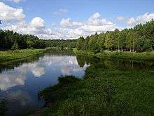
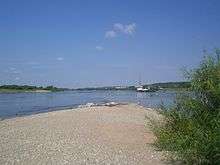
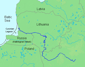
Neris (![]() pronunciation , Belarusian: Ві́лія Viliya, Polish: Wilia) is a river rising in Belarus. It flows through Vilnius (Lithuania) and becomes a tributary of the Neman River (Nemunas) at Kaunas (Lithuania). Its length is 510 km (320 mi).
pronunciation , Belarusian: Ві́лія Viliya, Polish: Wilia) is a river rising in Belarus. It flows through Vilnius (Lithuania) and becomes a tributary of the Neman River (Nemunas) at Kaunas (Lithuania). Its length is 510 km (320 mi).

For 276 km (171 mi)[1] the river runs through Belarus, where it is called Viliya, and 235 km (146 mi) runs through Lithuania, where it is called Neris.
The Neris connects two old Lithuanian capitals – Kernavė and Vilnius. Along its banks are burial places of the pagan Lithuanians. At 25 km (16 mi) from Vilnius are the old burial mounds of Karmazinai, with many mythological stones and a sacred oak.
Dual naming
The reasons for the dual naming of the river as Neris by the Lithuanians and Viliya (formerly Velja, meaning "big, great" in Slavic) by the Slavs are complex. Even in Vilnius, there are toponyms including both names, e. g. Neris remains in the riverside names of Paneriai and Paneriškės while Velja is a part of the name Valakampiai, which means "an angle of Velja" in Lithuanian.[2]
Although it has been suggested that Neris is the primeval name of the river, while name Viliya is of a secondary extraction,[3] the dual naming most probably emerged from the confluence of rivers Neris (now known as Narach River, leaving Lake Narach) and Velja, in the historical Slavic/Baltic borderland, each ethnos choosing their own name for the river starting at the confluence.[2] It is moreover evidenced by the fact that the name Neris was never used to name the river Velja up to this confluence. Therefore, it has been proposed that the Narach River had in fact been considered the upper reaches of Neris by the Balts in ancient times.[4]
Etymology of "Neris"
The name Neris is of Baltic origin, a cognate of the Lithuanian nerti generally meaning "to dive, swim downstream" as well as "to net, crochet". It is likely that the name had a more general meaning of "flow"[3] or particularly "swift and swirling flow"[5] in early times.
Etymologically, the name is one of a class of hydronyms, widespread in the modern and prehistoric Baltic ranges; e. g. Lithuanian Narotis, Narasa (rivers), Narutis (lake), Old Prussian Narus, Nara near Moscow. These are related to Lithuanian narus, "deep", and nerti, "to dive".
More remote connections are obscure, although the root is believed to be Indo-European. There are a number of possibilities:
- Pokorny's 2nd *ner-, "under" (Indogermanisches etymologisches Wörterbuch, pp765–766);
- Derksen's *nerH-, o-grade *norH- (Slavic Inherited Lexicon);
- A relation to the Greek god Nereus, which may be from *snau-, "to give milk to", in the sense of "flow" (Partridge, Origins (1983)).
- Another relationship of "Neris" with the Sanskrit word "Neer"/"Naar" which means water.
Basin

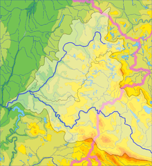
Total watershed is 25,100 km2 (9,700 sq mi), 10,920 km2 (4,220 sq mi) of which with are in Belarus.[1]
Basin within Belarus
The river is called Viliya in Belarus. There is the Belarus largest Vileyka Reservoir by Viliya, up off the Vileyka city.
Right tributaries
- Narach River
- Servach River
Left tributaries
- Iliya River
- Vusha River
- Oshmyanka River
Basin within Lithuania
The watershed within Lithuania is 13,849 km2 (5,347 sq mi)[6]
Tributaries
References
- 1 2 "Main Geographic Characteristics of the Republic of Belarus. Main characteristics of the largest rivers of Belarus". Land of Ancestors. Data of the Ministry of Natural Resources and Environmental Protection of the Republic of Belarus. 2011. Retrieved 27 September 2013.
- 1 2 Vykintas Vaitkevičius Mysterious Neris, Šiaurės Atėnai. 2005-07-23 nr. 758 Archived July 22, 2011, at the Wayback Machine.
- 1 2 Zinkevičius, Zigmas (2007). Senosios Lietuvos valstybės vardynas. Vilnius: Mokslo ir enciklopedijų leidybos institutas. p. 45. ISBN 5-420-01606-0.
- ↑ S. Kolupaila, Narutis ir Neris, Kosmos, 1940, Nr. 1/3, p. 52
- ↑ V. Mažiulis, Prūsų kalbos etimologijos žodynas, L-P, V., 1996, t. 3, p. 178-179
- ↑ Neries mažųjų intakų (su Nerimi) pabaseinis (Basin small tributaries of Neris (including Neris))
External links
-
 Media related to Neris at Wikimedia Commons
Coordinates: 54°54′01″N 23°52′27″E / 54.90028°N 23.87417°E
