Willis Ridge
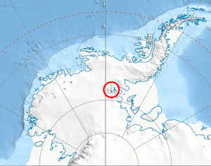
Location of Sentinel Range in Western Antarctica.
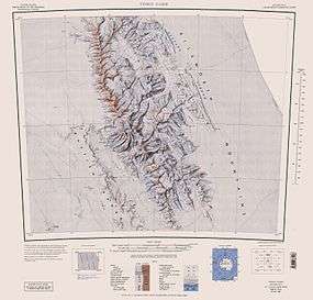
Central and southern Sentinel Range map.
Willis Ridge (78°36′S 85°0′W / 78.600°S 85.000°WCoordinates: 78°36′S 85°0′W / 78.600°S 85.000°W) is a narrow-crested ridge extending west–east between Aster Glacier and Sowers Glacier on the east side of Craddock Massif, Sentinel Range. It was named by the Advisory Committee on Antarctic Names in 2006 after Michael J. Willis, Ohio State University geologist in Antarctica for 7 field seasons, 1997–2006, including research at Siple Dome and the Whillans, Bindschadler and MacAyeal Ice Streams.
Maps
- Vinson Massif. Scale 1:250 000 topographic map. Reston, Virginia: US Geological Survey, 1988.
- Antarctic Digital Database (ADD). Scale 1:250000 topographic map of Antarctica. Scientific Committee on Antarctic Research (SCAR), 1993–2016.
References
-
 This article incorporates public domain material from the United States Geological Survey document "Willis Ridge" (content from the Geographic Names Information System).
This article is issued from Wikipedia - version of the 1/29/2016. The text is available under the Creative Commons Attribution/Share Alike but additional terms may apply for the media files.