Huitoni (mountain)
| Huitoni | |
|---|---|
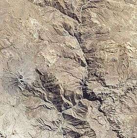 Satellite image of the volcano Ubinas (on the left) with Huitoni and Pacoorcco northeast of it (light-colored complex) | |
| Highest point | |
| Elevation | 4,800 m (15,700 ft) [1] |
| Coordinates | 16°19′03″S 70°49′32″W / 16.31750°S 70.82556°WCoordinates: 16°19′03″S 70°49′32″W / 16.31750°S 70.82556°W |
| Geography | |
 Huitoni Peru | |
| Location | Peru, Moquegua Region, General Sánchez Cerro Province |
| Parent range | Andes |
Huitoni or Wit'uni (Aymara wit'u spur,[2] -ni a suffix to indicate ownership, "the one with a spur", hispanicized spelling Huitoni) is a mountain in the Moquegua Region in the Andes of Peru, about 4,800 metres (15,748 ft) high. It is situated in the General Sánchez Cerro Province, Ubinas District. Huitoni lies northeast of the active volcano Ubinas and southwest of Pirhuane and Pacoorcco.[1]
See also
References
- 1 2 escale.minedu.gob.pe - UGEL map of the General Sánchez Cerro Province (Arequipa Region)
- ↑ Radio San Gabriel, "Instituto Radiofonico de Promoción Aymara" (IRPA) 1993, Republicado por Instituto de las Lenguas y Literaturas Andinas-Amazónicas (ILLLA-A) 2011, Transcripción del Vocabulario de la Lengua Aymara, P. Ludovico Bertonio 1612 (Spanish-Aymara-Aymara-Spanish dictionary)
This article is issued from Wikipedia - version of the 8/29/2016. The text is available under the Creative Commons Attribution/Share Alike but additional terms may apply for the media files.