Wyoming Highway 160
| ||||
|---|---|---|---|---|
| Route information | ||||
| Maintained by WYDOT | ||||
| Length: | 1.08 mi[1] (1.74 km) | |||
| Major junctions | ||||
| West end: |
| |||
| East end: |
| |||
| Location | ||||
| Counties: | Goshen | |||
| Highway system | ||||
| ||||

Wyoming Highway 160 is a short east-west Wyoming State Road located in western Goshen County in the town of Fort Laramie.
Route description
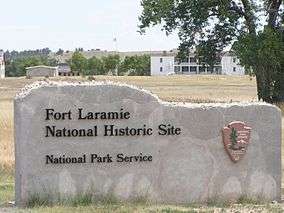
Wyoming Highway 160 is a short route at only 1.08 miles (1.74 km) in length that provides access to the Fort Laramie National Historic Site and areas west and southwest of Fort Laramie. Highway 160 begins at Goshen CR 53[2] and travels east, passing north of the Fort Laramie Historic Site. WYO 160 crosses the North Platte River before reaching Fort Laramie where the highway ends at US Route 26 (Merriam Street).[1][2]
History
Wyoming Highway 160 may have previously been routed all the way to Interstate 25 (Exit 80) in Wheatland.[3] WYO 160 would have traveled south of Grayrocks Reservoir to Wheatland. The roadway today appears to be a county-maintained road.[2][3]
Major intersections
The entire route is in Goshen County.
| Location | mi | km | Destinations | Notes | |
|---|---|---|---|---|---|
| west of Fort Laramie | 0.00 | 0.00 | Western terminus of WYO 160 | ||
| Fort Laramie | 1.08 | 1.74 | Eastern terminus of WYO 160 | ||
| 1.000 mi = 1.609 km; 1.000 km = 0.621 mi | |||||
References
- 1 2 Wyoming Department of Transportation Reference Marker Book - November 2004 (PDF) (Map). WYDOT. Archived from the original (PDF) on July 17, 2011. Retrieved 2010-02-12.
- 1 2 3 Google (5 September 2016). "Wyoming Highway 160" (Map). Google Maps. Google. Retrieved 5 September 2016.
- 1 2 Wyoming @ AARoads.com - Wyoming Routes 100-199
- Official 2003 State Highway Map of Wyoming
External links
- Wyoming State Routes 100-199
- WYO 160 - US 26 to Fort Laramie National Historic Site
- National Park Service - Fort Laramie National Historic Site