Yahtse Glacier
| Yahtse Glacier | |
|---|---|
|
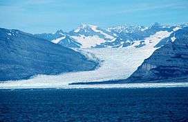
Yahtse Glacier as it appeared in 1977 | |
| Type | Valley glacier |
| Location | Yakutat City and Borough, Alaska, U.S. |
| Coordinates | 60°18′20″N 141°43′37″W / 60.30556°N 141.72694°WCoordinates: 60°18′20″N 141°43′37″W / 60.30556°N 141.72694°W |
| Length | 40 miles (64 km) |
| Terminus | Sealevel |
| Status | Advancing |
Yahtse Glacier is a 40-mile-long (64 km) glacier in the U.S. state of Alaska.[1] It begins on the southeast slope of Mount Miller and trends southeast along the north border of Guyot Glacier to Icy Bay, just east of Guyot Hills and 70 miles (113 km) northwest of Yakutat. The western extent is an icefield. The name derives from the Yahtse River and was adopted after the retreat of Guyot Glacier resulted in a separate branch.[2]
See also
Cited references
- ↑ "USGS Bering Glacier B-2 (AK) Topo Map". Topozone. Retrieved 2007-01-24.
- ↑ "USGS Geographic Names Information System". Retrieved 2014-07-13.
This article is issued from Wikipedia - version of the 1/13/2016. The text is available under the Creative Commons Attribution/Share Alike but additional terms may apply for the media files.