Yapu Qullu (Sajama)
This article is about the mountain in the Sajama Province, Oruro Department, Bolivia. For other uses, see Yapu Qullu.
| Yapu Qullu | |
|---|---|
 Yapu Qullu Location in Bolivia | |
| Highest point | |
| Elevation | 4,148 m (13,609 ft) [1] |
| Coordinates | 18°24′24″S 68°50′12″W / 18.40667°S 68.83667°WCoordinates: 18°24′24″S 68°50′12″W / 18.40667°S 68.83667°W |
| Geography | |
| Location |
Bolivia Oruro Department, Sajama Province, Turco Municipality |
| Parent range | Andes, Cordillera Occidental |
Yapu Qullu (Aymara yapu field, qullu mountain,[2] "field mountain", also spelled Yapu Kkollu, Yapukkollu) is a dome[3] in the Cordillera Occidental of Bolivia southeast of the summit of the Chullkani volcano. It is located in the Oruro Department, Sajama Province, Turco Municipality, east of the Sajama River and southwest of a plain named Titi Pampa.[4] The peak of Yapu Qullu reaches a height of 4,148 m (13,609 ft).[1]
References
- 1 2 Bolivian IGM map 1:50,000 Chachacomani 5838-IV
- ↑ Radio San Gabriel, "Instituto Radiofonico de Promoción Aymara" (IRPA) 1993, Republicado por Instituto de las Lenguas y Literaturas Andinas-Amazónicas (ILLLA-A) 2011, Transcripción del Vocabulario de la Lengua Aymara, P. Ludovico Bertonio 1612 (Spanish-Aymara-Aymara-Spanish dictionary)
- ↑ Gabriela Vargas-Mattos, Mauro César Geraldes, Ramiro Matos Salinas, Reconstrucción geológica del volcán Chullcani (mioceno superior a plioceno superior): Consideraciónes generales sobre geoquímica y edad de las fases volcánicas, Andes Centrales de Bolivia, Revista Brasileira de Geociências, 12/2006
- ↑ "Turco". Retrieved January 22, 2016. (unnamed, southwest of Titi Pampa)
Capital: Oruro | ||
| Provinces | 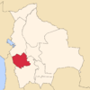 | |
| Municipalities (and seats) |
| |
This article is issued from Wikipedia - version of the 4/11/2016. The text is available under the Creative Commons Attribution/Share Alike but additional terms may apply for the media files.