Yarinaqucha
This article is about lake. For the administrative division, see Yarinacocha District.
| Yarinaqucha | |
|---|---|
 | |
| Location | Ucayali Region |
| Coordinates | 13°51′24″S 71°01′30″W / 13.85667°S 71.02500°WCoordinates: 13°51′24″S 71°01′30″W / 13.85667°S 71.02500°W |
| Basin countries | Peru |
| Max. length | 15.45 km (9.60 mi) |
| Max. width | 0.82 km (0.51 mi) |
| Surface elevation | 149 m (489 ft) |
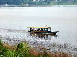
Yarinaqucha (Quechua yarina ivory palm, qucha lake,[1][2] "ivory palm lake", also spelled Yarinacocha) is a lake in Peru located in the Ucayali Region, Coronel Portillo Province, Yarinacocha District.[3] It is situated at a height of about 149 metres (489 ft), about 15.45 km long and 0.82 km at its widest point. Yarinaqucha lies west of the Ucayali River and northwest of Pucallpa.
See also
References
- ↑ museos-ecuador.gob.ec
- ↑ Teofilo Laime Ajacopa, Diccionario Bilingüe Iskay simipi yuyayk'ancha, La Paz, 2007 (Quechua-Spanish dictionary)
- ↑ escale.minedu.gob.pe - UGEL map of the Coronel Portillo Province (Ucayali Region)
- INEI, Compendio Estadistica 2007, page 26
This article is issued from Wikipedia - version of the 11/4/2016. The text is available under the Creative Commons Attribution/Share Alike but additional terms may apply for the media files.