Yeruham Dam
| Yeruham Dam | |
|---|---|
 Downstream face of the dam | |
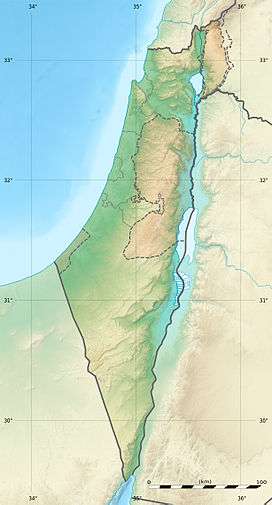 Location of Yeruham Dam in Israel | |
| Country | Israel |
| Location | Yeruham |
| Coordinates | 30°59′23.28″N 34°53′29.08″E / 30.9898000°N 34.8914111°ECoordinates: 30°59′23.28″N 34°53′29.08″E / 30.9898000°N 34.8914111°E |
| Purpose | Flood control, irrigation, municipal water, tourism, recreation |
| Status | Operational |
| Construction began | 1951 |
| Opening date | 1954 |
| Dam and spillways | |
| Type of dam | Masonry |
| Impounds | Revivim Stream |
| Height | 15 m (49 ft) |
| Length | 80 m (260 ft) |
| Spillway type | Overflow, uncontrolled |
| Reservoir | |
| Creates | Lake Yeruham |
| Total capacity | 9,000,000 m3 (7,300 acre·ft)[1] |
| Surface area | 60.7 ha (150 acres) |
The Yeruham Dam is a masonry dam on Revivim Stream, a tributary of the HaBesor Stream, in Yeruham, Southern District, Israel. The dam has many purposes to include flood control, irrigation, municipal water supply, tourism and recreation. Construction on the dam began in 1951 and it impounded Lake Yeruham between 1953 and 1954. In 1974 the area around the lake was improved with plants and facilities to improve recreation.[2]
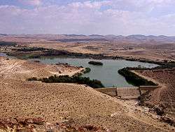
Yeruham Reservoir
References
- ↑ Israel Government Year Book. Central Office of Information. 1954. p. 51. Retrieved 28 February 2015.
- ↑ "Lake Yeruham" (in Hebrew). iNature. Retrieved 27 March 2014.
| Wikimedia Commons has media related to Yeruham lake. |
This article is issued from Wikipedia - version of the 2/28/2015. The text is available under the Creative Commons Attribution/Share Alike but additional terms may apply for the media files.