Yin River
For the river in China, see Shaying River.
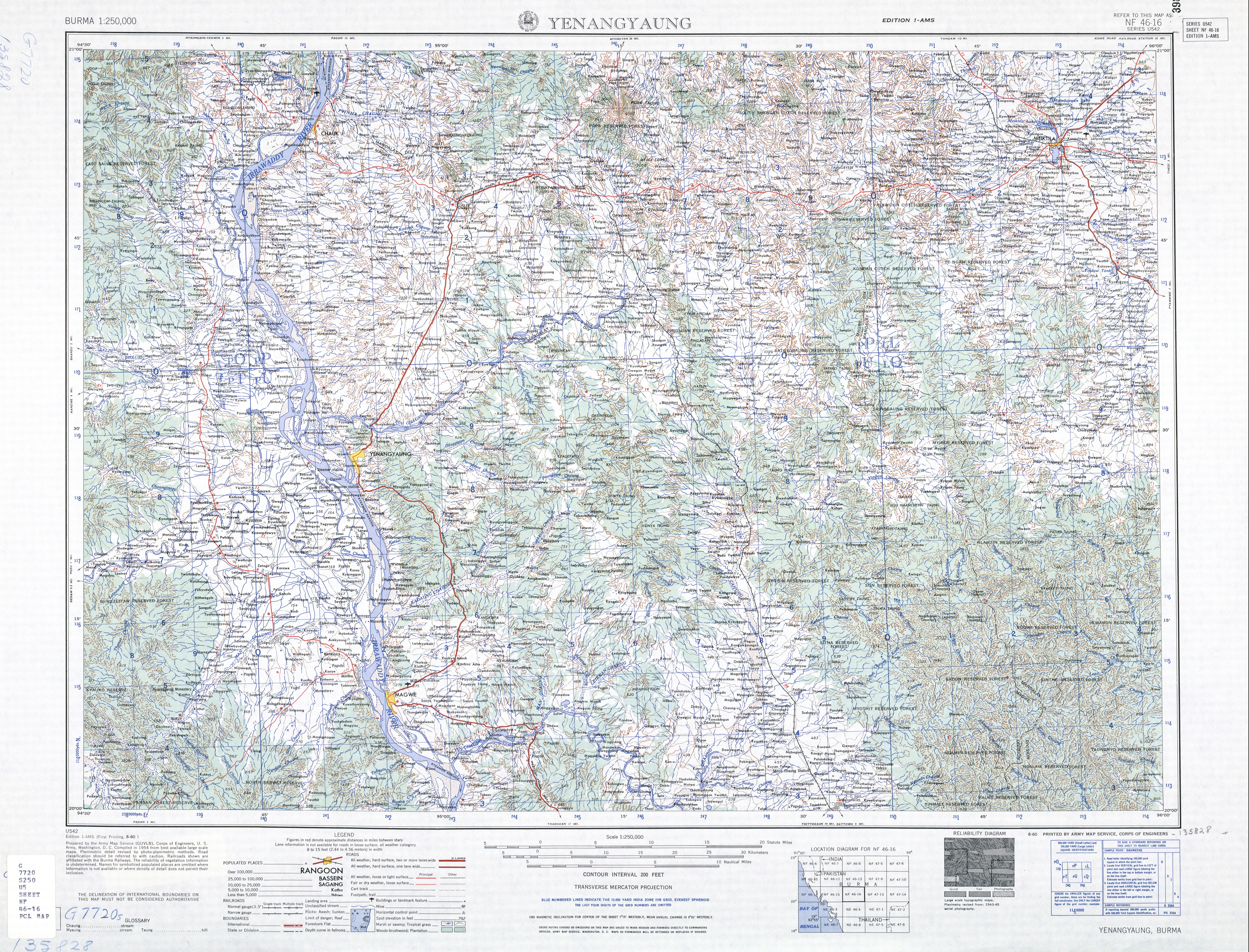
The Yin River (Yin Chaung)[1] is a river in Magway Region, in central Burma (Myanmar), a tributary of the Irrawaddy.
Arising off the southwestern slopes of Mount Natsim (1289 ft.) and the eastern slopes of Mount Okshitkon (1104 ft.) and Mount Setkya (1232 ft.), the Yin River flows south past the town of Natmauk and various other villages, turning west at about latitude 20.07° N.[2] Twisting and turning through the mountains it enters the Irrawaddy just below the city of Magway,[2] at 20°01′03″N 95°00′54″E / 20.01750°N 95.01500°ECoordinates: 20°01′03″N 95°00′54″E / 20.01750°N 95.01500°E.
See also
References
- ↑ "Yin Chaung". GEOnet Names Server. United States National Geospatial-Intelligence Agency.
- 1 2 Burma 1:250,000 topographic map, Series U542, NF 46-16 Yenangyaung U.S. Army Map Service, August 1960
This article is issued from Wikipedia - version of the 6/28/2016. The text is available under the Creative Commons Attribution/Share Alike but additional terms may apply for the media files.