Yoboki
| Yoboki | |
|---|---|
| Town | |
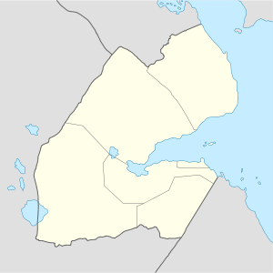 Yoboki Location in Djibouti | |
| Coordinates: 11°31′N 42°06′E / 11.517°N 42.100°E | |
| Country |
|
| Region | Dikhil |
| Elevation | 250 m (823 ft) |
| Population | |
| • Total | 644 |
Yoboki is a town located in the western Dikhil Region of Djibouti. It is situated approximately 100 km (62 mi) west of the nation's capital city of Djibouti, and roughly 40 km (25 mi) northwest of Dikhil, the regional capital.
History
Yoboki was established as a French military post in 1946,[1] and buildings were constructed between July and November 1947 at the location of a well. The first meeting between the French soldiers, who began to occupy the territory, and representatives of the Sultan of Awsa, including Mahammad Yayyó, took place here. In 1958, a school was opened for the nomads.[2] In 1979 a French teacher was kidnapped in Yoboki.[3]
Bomb attacks by an unknown perpetrator were reported in mid-May 1990, which affected electric and military installations in the town.[4] Due to conflict in the area between rebels and the government, since March 28 1992[5] troops from the 5th Interarm Regiment of the French Overseas Navy have been deployed in Yoboki, Obock, and Tadjoura.[6] The rebels were driven out to Gorabous.[7] According to an October 1993 Amnesty International publication, "50 civilians were reportedly extrajudicially executed by government troops after a FRUD force withdrew from the village."[8]
In late November-December 1998, the area was occupied by the Ethiopian army.[9][10] However, the Djibouti Army re-took the town in February 1999.
Demographics
In 1968, Yoboki had a population of around 200 residents, mostly Afar.[11] More recent estimates indicate that the town has a population of 644.
Geography and climate
Yoboki is located at an altitude of 250 meters above sea level in the hills, rising to 972 meters at Babba Alou.[12] Yoboki National Park surrounds the town and Hanle Valley is in the vicinity.[13] The area is prone to earthquakes and landslides.[14]
| Climate data for Yoboki | |||||||||||||
|---|---|---|---|---|---|---|---|---|---|---|---|---|---|
| Month | Jan | Feb | Mar | Apr | May | Jun | Jul | Aug | Sep | Oct | Nov | Dec | Year |
| Average high °C (°F) | 25.2 (77.4) |
26.1 (79) |
27.9 (82.2) |
29.8 (85.6) |
32.6 (90.7) |
35.1 (95.2) |
34.2 (93.6) |
33.4 (92.1) |
33.1 (91.6) |
29.7 (85.5) |
27.1 (80.8) |
25.6 (78.1) |
29.98 (85.98) |
| Average low °C (°F) | 18.4 (65.1) |
19.6 (67.3) |
21.1 (70) |
23.3 (73.9) |
26.6 (79.9) |
27.8 (82) |
25.7 (78.3) |
24.5 (76.1) |
23.3 (73.9) |
22.5 (72.5) |
20.4 (68.7) |
19.0 (66.2) |
22.68 (72.83) |
| Average rainfall mm (inches) | 6 (0.24) |
6 (0.24) |
11 (0.43) |
5 (0.2) |
2 (0.08) |
2 (0.08) |
44 (1.73) |
54 (2.13) |
20 (0.79) |
2 (0.08) |
4 (0.16) |
4 (0.16) |
160 (6.32) |
| Source: Levoyageur Weather[15] | |||||||||||||
Transport
Yoboki is well connected, linked by National Highway 1, National Highway 7 and National Highway 8; these roads lead to other cities such as Dikhil, Galafi, Dobi[16]and Djibouti city.[17]
Notable people
- Moussa Mohamed Ahmed (1963-)[18]
References
- ↑ Chiré, Amina Saïd (2013). Djibouti contemporain. KARTHALA Editions. p. 58. ISBN 978-2-8111-0824-3.
- ↑ Kitchen, Helen A. (1962). The Educated African: A Country by Country Survey of Educational Development in Africa. Praeger. p. 111.
- ↑ Alwan, Daoud Aboubaker; Mibrathu, Yohanis (2000). Historical Dictionary of Djibouti. Scarecrow Press. p. 51. ISBN 978-0-8108-3873-4.
- ↑ Economist Intelligence Unit (Great Britain) (1990). Country report: Uganda, Ethiopia, Somalia, Djibouti. The Unit. Retrieved 8 March 2011.
- ↑ Country Report: Uganda, Ethiopia, Somalia, Djibouti. The Unit. 1992. p. 40.
- ↑ Africa. Routledge. 2006. p. 357. ISBN 978-0-415-39822-0.
- ↑ Africa Research Bulletin: Political, social, and cultural series. Blackwell. 1992. p. 10428.
- ↑ Getting away with murder: political killings and d̀isappearances' in the 1990s. Amnesty International. 1 October 1993. p. 32. ISBN 978-0-939994-82-3.
- ↑ Ethiopian Weekly Press Digest. Anasir Publishers. 1998. p. 298.
- ↑ Africa contemporary record: annual survey and documents. Africana Publishing Co. 2002. ISBN 978-0-8419-1222-9.
- ↑ Thompson, Virginia; Richard Adloff (1968). Djibouti and the Horn of Africa. Stanford University Press. p. 47. ISBN 978-0-8047-0650-6. Retrieved 8 March 2011.
- ↑ Auzias, Dominique; Labourdette, Jean-Paul (9 September 2006). Petit Futé Djibouti (in French). Petit Futé. p. 123. ISBN 978-2-7469-1763-7.
- ↑ Muslim & Arab Perspectives: International Islamic Magazine. Institute of Islamic and Arabic Studies. 1996. p. 12.
- ↑ Earthquakes & Volcanoes. Geological Survey. 1986. p. 160.
- ↑ "Levoyageur Weather : Djibouti". Retrieved 11 July 2012.
- ↑ Development, Ethiopian International Institute for Peace and; Africa, United Nations. Economic Commission for (1998). Economic integration in the IGAD sub-region. EIIPD. p. 19.
- ↑ Inc, Gale Research (1995). Worldmark Encyclopedia of the Nations: Africa. Gale Research. p. 112. ISBN 978-0-8103-9880-1.
- ↑ The Indian Ocean Newsletter. Indian Ocean Information and Documentation Bank (B.I.D.O.I.). 2002.
External links
Coordinates: 11°31′N 42°06′E / 11.517°N 42.100°E