Yurrebilla Trail
| Yurrebilla Trail | |
|---|---|
|
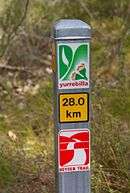
Trail marker on a section shared with the Heysen Trail | |
| Established | 2 September 2003[1] |
| Length | 54 km (34 mi)[1] |
| Location | South Australia |
| Trailheads | Belair railway station & Ambers Gully[1] |
| Use | Hiking |
The Yurrebilla Trail is a walking trail passing through the Mount Lofty Ranges in the immediate vicinity of Adelaide, South Australia. It is named after the adopted indigenous moniker for the Greater Mount Lofty Parklands, itself an extension of the parklands around the city of Adelaide itself.
The trail is 54 km long and runs from Belair railway station (at Belair National Park) in the south to the River Torrens at Ambers Gully in the north. Mostly traversing the hills face, it also passes through several conservation parks, in particular Cleland, the upper section of Horsnells Gully,[2] Giles,[2] Morialta, and Black Hill, and scales the summit of Mount Lofty. Much of the trail consists of old footpads, fire tracks, road reserves, and roads rebadged, the trail has been marked along it, and linked to form a coherent trail from north to south. Some sections of it are new, however, and panoramic views of the city and Adelaide Plains are to be had from every section. It was officially opened on 2 September 2003.[1]
The trail is divided into one full-day and four half-day sections:[1]
- Belair Railway Station to Eagle On The Hill (17.5 km)[3]
- Eagle-on-the-Hill to Summertown (7 km)[4]
- Summertown to Norton Summit (9 km)[5]
- Norton Summit to Morialta (7.5 km)[6]
- Morialta to Ambers Gully (River Torrens) (13 km)[7]
Each section is readily accessible by car from central Adelaide.
References
- 1 2 3 4 5 "Yurrebilla". Office for Recreation and Sport. Retrieved 10 April 2014.
- 1 2 "Horsnell Gully Conservation Park and Giles Conservation Park (brochure, revised October 2010)" (PDF). Department of Environment Water and Natural Resources. Retrieved 10 April 2014.
- ↑ "Section 1: Belair National Park to Eagle on the Hill, Yurrebilla Trail". Walking SA. Retrieved 10 April 2014.
- ↑ "Section 2: Eagle on the Hill to Summertown, Yurrebilla Trail". Walking SA. Retrieved 10 April 2014.
- ↑ "Section 3: Summertown to Norton Summit, Yurrebilla Trail". Walking SA. Retrieved 10 April 2014.
- ↑ "Section 4: Norton Summit to Morialta, Yurrebilla Trail". Walking SA. Retrieved 10 April 2014.
- ↑ "Section 5: Morialta to River Torrens, Yurrebilla Trail". Walking SA. Retrieved 10 April 2014.
34°52′S 138°43′E / 34.86°S 138.72°E