Zeilberg
| Zeilberg | |
|---|---|
 Zeilberg | |
| Highest point | |
| Elevation | 462.9 m above sea level (NHN) (1,519 ft) |
| Coordinates | 50°11′48″N 10°41′18″E / 50.196781°N 10.688419°ECoordinates: 50°11′48″N 10°41′18″E / 50.196781°N 10.688419°E |
| Geography | |
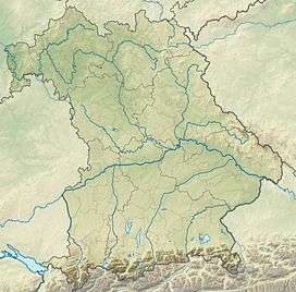
| Location | Haßberge Nature Park, Bavaria, Germany |
| Parent range | Zeilberge, Itz-Baunach Hills |
| Geology | |
| Age of rock | 16 MYA |
| Mountain type | volcano |
The Zeilberg is a hill, 463 m above NHN,[1] in the Haßberge Nature Park and county of Haßberge in eastern Lower Franconia, about 2 kilometres (1.2 mi) east of Maroldsweisach. It is one of the few still recognisable volcanoes of the Heldburger Gangschar and gives its name to the Zeilberge, which are the highest part of the Itz-Baunach Hills that are geologically part of the actual Haßberge to the west, but are separated from them by the Baunach valley.
The extinct volcano is 16 million years old and is formed of nephelinite.[2] It has been reduced in height due to extraction from a basalt quarry.
Tourism
An adventure trail runs around the basalt quarry. The Haus am Zeilberg is also a popular venue for events.
References
- ↑ Kartendienste Archived December 19, 2012, at the Wayback Machine. des BfN
- ↑ Der Vulkan von Oberleinleiter: Spuren eines Maars in der Nördlichen Frankenalb (pdf; 2.6 MB) – Gottfried Hofbauer, NHG Nürnberg (pdf, 2.47 MB)
This article is issued from Wikipedia - version of the 11/15/2016. The text is available under the Creative Commons Attribution/Share Alike but additional terms may apply for the media files.