Šentvid pri Lukovici
| Šentvid pri Lukovici | |
|---|---|
| Village | |
|
Postcard of Šentvid pri Lukovici | |
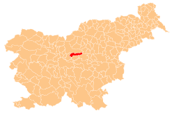
 Šentvid pri Lukovici Location in Slovenia | |
| Coordinates: 46°9′46.28″N 14°40′29.06″E / 46.1628556°N 14.6747389°ECoordinates: 46°9′46.28″N 14°40′29.06″E / 46.1628556°N 14.6747389°E | |
| Country |
|
| Traditional region | Upper Carniola |
| Statistical region | Central Slovenia |
| Municipality | Lukovica |
| Area | |
| • Total | 0.66 km2 (0.25 sq mi) |
| Elevation | 329.7 m (1,081.7 ft) |
| Population (2002) | |
| • Total | 208 |
| [1] | |

Šentvid pri Lukovici (pronounced [ʃɛnˈtʋiːt pɾi ˈluːkɔʋitsi] or [ʃənˈtʋiːt pɾi ˈluːkɔʋitsi]; German: Sankt Veit[2]) is a settlement in the Municipality of Lukovica in the eastern part of the Upper Carniola region of Slovenia.[3]
Name
The name of the settlement was changed from Šent Vid to Šentvid pri Lukovici in 1955.[4] The settlement gets its name from the local church, dedicated to Saint Vitus (Slovene: sveti Vid). In the past the German name was Sankt Veit.[2]
References
- ↑ Statistical Office of the Republic of Slovenia
- 1 2 Leksikon občin kraljestev in dežel zastopanih v državnem zboru, vol. 6: Kranjsko. 1906. Vienna: C. Kr. Dvorna in Državna Tiskarna, p. 22.
- ↑ Lukovica municipal site
- ↑ Spremembe naselij 1948–95. 1996. Database. Ljubljana: Geografski inštitut ZRC SAZU, DZS.
External links
This article is issued from Wikipedia - version of the 1/6/2016. The text is available under the Creative Commons Attribution/Share Alike but additional terms may apply for the media files.