Šklendrovec
| Šklendrovec | |
|---|---|
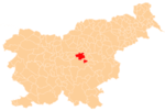
 Šklendrovec Location in Slovenia | |
| Coordinates: 46°7′7.88″N 14°59′30.65″E / 46.1188556°N 14.9918472°ECoordinates: 46°7′7.88″N 14°59′30.65″E / 46.1188556°N 14.9918472°E | |
| Country |
|
| Traditional region | Lower Carniola |
| Statistical region | Central Sava |
| Municipality | Zagorje ob Savi |
| Area | |
| • Total | 2.89 km2 (1.12 sq mi) |
| Elevation | 228 m (748 ft) |
| Population (2002) | |
| • Total | 160 |
| [1] | |
Šklendrovec (pronounced [ˈʃkleːndɾɔʋəts]) is a settlement in the Municipality of Zagorje ob Savi in central Slovenia. It lies on the right bank of the Sava River and extends southeastwards into the hills towards Podkum. The area is part of the traditional region of Lower Carniola. It is now included with the rest of the municipality in the Central Sava Statistical Region.[2]
References
External links
This article is issued from Wikipedia - version of the 1/4/2016. The text is available under the Creative Commons Attribution/Share Alike but additional terms may apply for the media files.