1945 Atlantic hurricane season
| |
| Season summary map |
| First system formed |
June 20, 1945 |
| Last system dissipated |
October 13, 1945 |
| Strongest storm1 |
"Homestead" – 949 mbar (hPa) (28.02 inHg), 130 mph (215 km/h) (1-minute sustained) |
| Total depressions |
16 |
| Total storms |
11 |
| Hurricanes |
5 |
| Major hurricanes (Cat. 3+) |
2 |
| Total fatalities |
29 |
| Total damage |
$80 million (1945 USD) |
| 1Strongest storm is determined by lowest pressure |
Atlantic hurricane seasons
1943, 1944, 1945, 1946, 1947 |
The 1945 Atlantic hurricane season officially began on June 16, 1945, and lasted until October 31, 1945. These dates conventionally delimit the period of each year when most tropical cyclones form in the Atlantic basin.
The 1945 season was an average season, with 11 tropical storms. 5 storms became hurricanes, of which 2 reached major hurricane strength. Notable storms include a Category 3 hurricane hitting Port Aransas, Texas, and a Category 4 hurricane hitting near Homestead, Florida.
Storms
Hurricane One
| Category 2 hurricane (SSHWS) |
|
|
| Duration |
June 20 – June 27 |
| Peak intensity |
100 mph (155 km/h) (1-min) 985 mbar (hPa) |
The first tropical storm of the 1945 season formed in the western Caribbean Sea on June 20. It moved northward through the Yucatan Channel, and rapidly intensified to a 100 mph (160 km/h) Category 2 hurricane on June 23. It turned northeast over the Gulf of Mexico, and steadily weakened to a minimal hurricane at the time of its western Florida landfall near Cedar Key on June 24. It continued northeastward, hitting Cape Hatteras on June 26, and became extratropical on June 28 over the northern North Atlantic, and the system later dissipated on July 1. The hurricane caused only minor damage.
Tropical Storm Two
| Tropical storm (SSHWS) |
|
|
| Duration |
July 19 – July 22 |
| Peak intensity |
40 mph (65 km/h) (1-min) 1008 mbar (hPa) |
A weak tropical storm, which formed in the northwest Gulf of Mexico on July 19, hit southern Texas on July 22, causing no reported damage.
Tropical Storm Three
| Tropical storm (SSHWS) |
|
|
| Duration |
August 2 – August 4 |
| Peak intensity |
60 mph (95 km/h) (1-min) 1005 mbar (hPa) |
On August 1, a tropical storm formed east-southeast of Barbados and moved through the Lesser Antilles on August 2. It continued west-northwestward, hitting southern Hispaniola on August 4 where it soon dissipated.
Tropical Storm Four
| Tropical storm (SSHWS) |
|
|
| Duration |
August 17 – August 21 |
| Peak intensity |
70 mph (110 km/h) (1-min) 999 mbar (hPa) |
A short-lived tropical storm formed east-northeast of the Leeward Islands on August 17. Moving west-northwest, the system peaked at 70 mph before weakening on August 19. It weakened to a depression on August 21 and dissipated in the Bahamas.
Hurricane Five
| Category 3 hurricane (SSHWS) |
|
|
| Duration |
August 24 – August 29 |
| Peak intensity |
115 mph (185 km/h) (1-min) 963 mbar (hPa) |
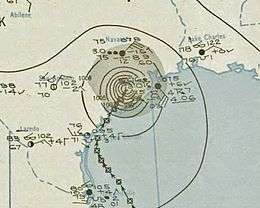
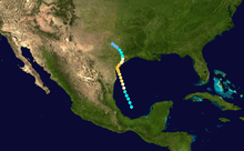
An area of convection over the Bay of Campeche rapidly developed on August 24, reaching hurricane strength that night. It moved northward, paralleling the Mexican and Texas coastlines while intensifying, and made landfall on August 28 near Port Aransas in central Texas as a 115 mph (185 km/h) Category 3 hurricane. The hurricane weakened to a 75 mph (120 km/h) Category 1 hurricane shortly after moving inland and passing near Houston, and the system weakened to a tropical storm shortly thereafter before weakening to a depression and dissipating inland over central Texas on August 29. Towns from Freeport to Brownsville were subjected to hurricane-force winds, causing around $20 million (1945 US dollars) in damages, and three deaths.
Tropical Storm Six
| Tropical storm (SSHWS) |
|
|
| Duration |
August 29 – September 1 |
| Peak intensity |
70 mph (110 km/h) (1-min) 990 mbar (hPa) |
On August 29, a tropical storm formed in the western Caribbean Sea. It moved northeastward, turned to the west, and made landfall in Belize as a strong tropical storm (possibly a Category 1 hurricane) on August 31 where it caused heavy rains and high tides. The system weakened to a depression after moving inland on September 1, and the remnants dissipated over interior Central America shortly thereafter.
Tropical Storm Seven
| Tropical storm (SSHWS) |
|
|
| Duration |
September 3 – September 6 |
| Peak intensity |
40 mph (65 km/h) (1-min) 1008 mbar (hPa) |
A tropical storm hit Cuba on September 4 and continued northeastward to hit southwest Florida. It turned to the northwest, and dissipated on September 6 over Louisiana after causing minor damage to boats.
Tropical Storm Eight
| Tropical storm (SSHWS) |
|
|
| Duration |
September 9 – September 12 |
| Peak intensity |
60 mph (95 km/h) (1-min) 1009 mbar (hPa) |
Another short-lived tropical storm formed east of the Leeward Islands on September 10. The system moved north-northwest, quickly reaching its peak of 60 mph (95 km/h) late on September 10 before gradually weakening on September 11. Turning more to the north, the system dissipated after weakening to a depression just west-northwest of Bermuda on September 12.
Hurricane Nine
| Category 4 hurricane (SSHWS) |
|
|
| Duration |
September 12 – September 18 |
| Peak intensity |
130 mph (215 km/h) (1-min) ≤ 949 mbar (hPa) |
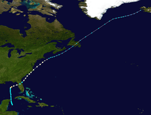
On September 12, a hurricane was first observed east of the northern Lesser Antilles. It moved west-northwestward, moving through the Bahamas on September 15 as a strengthening major hurricane. After reaching its peak as a Category 4 hurricane, the cyclone made landfall in South Florida near Homestead on September 16 with maximum sustained winds estimated at 135 mph (217 km/h). Shortly after making landfall, the hurricane turned north over the peninsula, and the system weakened while moving up the Eastern Seaboard of the United States. The once-hurricane became extratropical on September 18 near Washington, D.C., and continued for 2 more days as it raced across the northern North Atlantic. The hurricane caused $60 million (1945 US dollars) in damage and 26 deaths, including a firefighter trying to put out a fire in the Richmond Naval Air Station in southeastern Florida where three light hangars exploded when high winds ignited a high-octane gas fire.
Hurricane Ten
| Category 1 hurricane (SSHWS) |
|
|
| Duration |
October 2 – October 7 |
| Peak intensity |
90 mph (150 km/h) (1-min) 982 mbar (hPa) |
A tropical storm first detected on October 2 moved westward across the western Caribbean. It reached a peak of 90 mph (150 km/h) winds as a strong Category 1 hurricane, and hit southern Belize on October 4. It maintained its circulation across Central America, and hit Acapulco, Mexico on October 5 as a weakening tropical depression. The hurricane caused severe damage in southern Belize and northwestern Guatemala, but no damage figures exist. A hurricane crossing from the Atlantic to the Pacific is a relatively rare event.
Hurricane Eleven
| Category 2 hurricane (SSHWS) |
|
|
| Duration |
October 10 – October 13 |
| Peak intensity |
100 mph (155 km/h) (1-min) ≤ 982 mbar (hPa) |
The final hurricane of the season began its life on October 10 in the Caribbean Sea. It moved northward, eventually reaching a peak of 100 mph (160 km/h) winds before striking Cuba on October 12 as a Category 2 hurricane at its peak intensity. The hurricane continued northeastward, and became extratropical on October 14. The system dissipated on October 16.
This hurricane is not included in this year's Monthly Weather Review.[1] Until as late as 1956, this system was unrecorded. Later, in July 1966, new work on this hurricane was published.[2] This system is currently in HURDAT "best track".[3]
See also
References
External links
|
|---|
|
| |
|
-
 Book Book
-
 Category Category
-
 Portal Portal
-
 WikiProject WikiProject
-
 Commons Commons
|


