1978 Tabas earthquake
 Tehran | |
| Date | September 16, 1978 |
|---|---|
| Origin time | 15:35:55 UTC [1] |
| Magnitude | 7.4 Mw [1] |
| Depth | 10 km (6.2 mi) [1] |
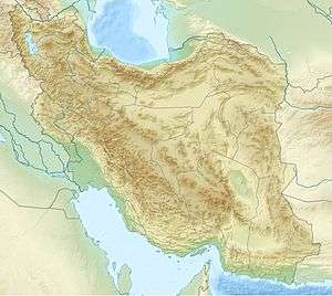
| Epicenter | 33°13′N 57°29′E / 33.21°N 57.48°ECoordinates: 33°13′N 57°29′E / 33.21°N 57.48°E [1] |
| Type | Dip-slip [2] |
| Areas affected | Iran |
| Total damage | $11 million [2] |
| Max. intensity | IX (Violent) [3] |
| Peak acceleration | .8g [4] |
| Aftershocks | 5.0 Mw Sept 17 at 08:17 [5] |
| Casualties | 15,000–25,000 [2] |
The 1978 Tabas earthquake occurred on September 16 at 19:05:55 local time in central Iran. The shock measured 7.4 on the moment magnitude scale and had a maximum Mercalli Intensity of IX (Violent). The death toll was in the range of 15,000–25,000 with severe effects in the town of Tabas.
Eighty percent of the loss of life occurred in Tabas, but a total of 85 villages were affected. This shock was felt in Tehran, about 610 kilometers (380 mi) away. About 55–85 km (34–53 mi) of ground deformation was observed, with about 1.7 meters (5 ft 7 in) of maximum slip. Only one significant M5 aftershock occurred.[4]
See also
References
- 1 2 3 4 ISC (19 January 2015), ISC-GEM Global Instrumental Earthquake Catalogue (1900–2009), Version 2.0, International Seismological Centre
- 1 2 3 USGS (September 4, 2009), PAGER-CAT Earthquake Catalog, Version 2008_06.1, United States Geological Survey
- ↑ USGS (December 1, 2008), EXPO-CAT Earthquake Catalog, Version 2007-12, United States Geological Survey
- 1 2 Ambraseys, N. N.; Melville, C. P.; Adams, R. D. (2005), The Seismicity of Egypt, Arabia and the Red Sea: A Historical Review, Cambridge University Press, pp. 103, 104, 110, ISBN 978-0521020251
- ↑ USGS. "M5.0 - eastern Iran". United States Geological Survey.
External links
This article is issued from Wikipedia - version of the 10/29/2016. The text is available under the Creative Commons Attribution/Share Alike but additional terms may apply for the media files.