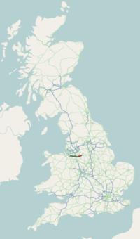
A54 road
| |
|---|---|
 | |
|
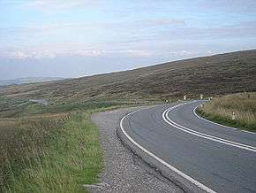
A54 road near Buxton in Derbyshire | |
| Route information | |
| Maintained by Cheshire County Council | |
| Length: | 41.9 mi (67.4 km) |
| Major junctions | |
| west end: |
Tarvin 53°11′42″N 2°46′36″W / 53.19513°N 2.77679°W |
|
J18 → M6 Motorway | |
| east end: |
Buxton 53°14′44″N 1°56′24″W / 53.24555°N 1.94012°W |
| Location | |
| Primary destinations: |
Congleton Winsford |
| Road network | |

The A54 road is a road in England linking Chester in Cheshire with Buxton in Derbyshire. Its route through both urban and steep rural areas presents a challenge to Cheshire County Council in maintaining the safety of the road.
History
Re-routing of the A54 away from the narrow cobbled streets of Congleton town centre was first proposed in 1935. Prior to this, at the point where the A34 now converges with the A54 an unusual 28 ft (8.5 m) lighthouse was erected in 1924 bearing the words "Dangerous hill - change to low gear", backlit at night, to reduce accidents at the sharp bend.[1]
According to a 2007 report by the Road Safety Foundation for the European Road Assessment Programme (EuroRAP), the A54 is one of the most dangerous roads in the UK, second only to the A682 in Lancashire.[2]
Again in 2008 the road was rated as one of the highest-risk roads in Great Britain by EuroRAP, with a risk rating of Medium to High on its most dangerous stretch between Buxton and Congleton. Eighteen fatal or serious-injury accidents occurred on this 24-kilometre (15 mi) stretch of single-carriageway road between 2003 and 2005, 26% of which were accidents at junctions.[3]
Route
The road begins at a roundabout on the A51 near Tarvin, 5 miles (8.0 km) east of Chester. It is a single carriageway for almost its entire length, travelling west-east. The first town is Winsford, where the road takes a short section of dual carriageway through the town centre; unusually the suburbs have been bypassed while the main road runs directly along the High Street. In Winsford it crosses the River Weaver on a large roundabout having two bridges over the river.
After passing through Middlewich the A54 crosses over the M6 Motorway on a conventional roundabout interchange, through Holmes Chapel to Congleton where it has a short overlap with the A34. The road then becomes more rural in character as it crosses into Derbyshire, passing through the Peak District National Park and ending on a junction with the A53 on the edge of Buxton.
List of settlements
The road passes through or immediately adjacent to many towns and villages on its length. Only those with their own Wikipedia article are included here, listed in the order they appear along the road travelling west-east.
See also
References
- ↑ Stephens, W.B. (1970). History of Congleton. Manchester University Press. p. 109. Retrieved 4 July 2015.
- ↑ "'Most dangerous' roads revealed". bbc.com. 25 June 2007.
- ↑ "GB Tracking Survey Results". EuroRAP. 30 June 2008.
A roads in Zone 5 of the Great Britain road numbering scheme | ||
|---|---|---|