A591 road
| |
|---|---|
| Route information | |
| Length: | 43 mi (69 km) |
| Major junctions | |
| North end: | Bothel |
|
| |
| South end: | Sedgwick |
| Location | |
| Primary destinations: |
Keswick Grasmere Ambleside Windermere Kendal |
| Road network | |

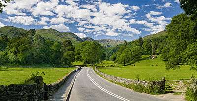
The A591 is a major road in Cumbria, in the north-west of England. The stretch of the road between Windermere and Keswick has been voted Britain's Favourite Road.[1] The 29.8 mile stretch between Kendal and Keswick was also named the UK's best driving road, according to a specially devised driving ratio formulated by car rental firm Avis.[2]
Route
The road begins (at its southern end) 3.5 miles (5.6 km) north-west of junction 36 of the M6 motorway at Brettargh Holt roundabout with the A590 road (54°16′29″N 2°45′38″W / 54.2746°N 2.7605°W), close to Sizergh Castle. It bypasses the town of Kendal as a dual carriageway, this £1.9m 3-mile (4.8 km) section opened on 29 August 1971. It becomes a busy single carriageway road as it enters the Lake District. It bypasses the town of Windermere, closely following the north-eastern bank of Lake Windermere. It then travels through the centre of Ambleside, follows the northern side of Rydal Water, passes White Moss Common, follows the eastern edge of Grasmere and passes the village of Grasmere. The road continues over Dunmail Raise and along the eastern edge of Thirlmere. Shortly afterwards it reaches the town of Keswick. It meets the A66 road at a grade-separated junction. Traffic then bypasses Keswick by following the A66 west for 2.2 km to a roundabout where the A591 resumes, continuing in a roughly north-westerly direction, with fine views over Bassenthwaite Lake. The road terminates at the village of Bothel, on the A595 road (54°44′09″N 3°16′24″W / 54.7357°N 3.2733°W). The Bothel-to-Keswick section has many acute bends and is particularly narrow in places, leading to many accidents.
Storm damage and closure
The road was badly damaged during Storm Desmond on 5 December 2015 including a part washed away at Dunmail Raise and landslip adjacent to Thirlmere. The closed section of road between Grasmere and Legburthwaite reopened on 11 May 2016.[3]
References
- ↑ "Britain's Favourite Road". Archived from the original on 19 June 2009. Retrieved 22 December 2009.
- ↑ http://www.contracthireandleasing.com/car-leasing-news/uks-best-driving-roads-revealed/
- ↑ "Storm Desmond: A591 reopens ahead of schedule". BBC News. 11 May 2016. Retrieved 18 May 2016.
External links
A roads in Zone 5 of the Great Britain road numbering scheme | ||
|---|---|---|
Coordinates: 54°29′38″N 3°02′19″W / 54.4939°N 3.0386°W