A847 road
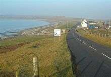
The A847 at Uiskentuie
| |
|---|---|
| Route information | |
| Length: | 14.7 mi[1] (23.7 km) |
| Major junctions | |
| North end: |
Bridgend 55°46′55″N 6°14′56″W / 55.7819°N 6.249°W |
|
| |
| South end: |
Portnahaven 55°40′51″N 6°30′23″W / 55.6808°N 6.5063°W |
| Road network | |

The A847 road is one of the two principal roads of Islay in the Inner Hebrides off the west coast of mainland Scotland.
It connects Bridgend, at a junction with the A846 road, with Portnahaven at the southern end of the Rinns of Islay peninsula. It is some 14 1⁄2 miles (23 km) long.
Settlements on or near the A847
North to South
- Bridgend
- Bruichladdich
- Port Charlotte
- Nerabus (Nereabolls)
- Easter Ellister
- Portnahaven
References
- ↑ "Driving directions to High St/A847". Google. Retrieved 23 September 2013.
A roads in Zone 8 of the Great Britain road numbering scheme | ||
|---|---|---|
Coordinates: 55°44′48″N 6°22′25″W / 55.74677°N 6.37357°W
This article is issued from Wikipedia - version of the 1/6/2016. The text is available under the Creative Commons Attribution/Share Alike but additional terms may apply for the media files.