A84 road
| |
|---|---|
|
Click map to enlarge | |
| Major junctions | |
| North end: |
Stirling 56°07′38″N 3°56′16″W / 56.1273°N 3.9379°W |
| South end: |
Lochearnhead 56°23′07″N 4°17′15″W / 56.3854°N 4.2874°W |
| Location | |
| Primary destinations: | Stirling, Callander, Lochearnhead |
| Road network | |

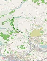
The A84 is a major road in Scotland, United Kingdom. It links the city of Stirling with Lochearnhead, running an approximate 28 miles (45 km).
Road safety
The A84 between M9 Junction 10 and Lochearnhead has a poor road safety record, according to EuroRAP. In its June 2008 GB Tracking Results, the Road Safety Foundation reported that the 44 km single carriageway stretch featured 29 fatal and serious injury accidents between 2003 and 2005.[1]
References
A roads in Zone 8 of the Great Britain road numbering scheme | ||
|---|---|---|
Coordinates: 56°14′19″N 4°11′46″W / 56.2385°N 4.1960°W
This article is issued from Wikipedia - version of the 8/11/2013. The text is available under the Creative Commons Attribution/Share Alike but additional terms may apply for the media files.