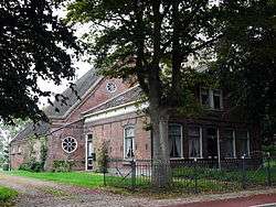
Aartswoud
| Aartswoud | |
|---|---|
| Village | |
 | |
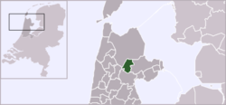 | |
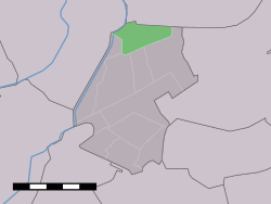 Aartswoud in the municipality of Opmeer. | |
| Coordinates: 52°44′40″N 4°57′13″E / 52.74444°N 4.95361°ECoordinates: 52°44′40″N 4°57′13″E / 52.74444°N 4.95361°E | |
| Country | Netherlands |
| Province | North Holland |
| Municipality | Opmeer |
| Population (1 January 2005) | |
| • Total | 490 |
| Time zone | CET (UTC+1) |
| • Summer (DST) | CEST (UTC+2) |
Aartswoud (West Frisian: Ierswou) is an unincorporated village in the Dutch province of North Holland. It is a part of the municipality of Opmeer, and lies about 12 kilometres (7.5 mi) northeast of Heerhugowaard.
The statistical area "Aartswoud", which also can include the surrounding countryside, has a population of around 490.[1]
References
- ↑ Statistics Netherlands (CBS), Statline: Kerncijfers wijken en buurten 2003-2005. As of 1 January 2005.
|
This article is issued from Wikipedia - version of the 9/10/2015. The text is available under the Creative Commons Attribution/Share Alike but additional terms may apply for the media files.