Abrahámovce, Bardejov District
| Abrahámovce | |
| Village | |
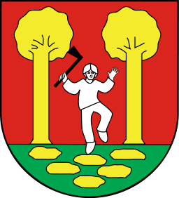 Coat-of-Arms for the village | |
| Country | Slovakia |
|---|---|
| Region | Prešov |
| District | Bardejov |
| Elevation | 265 m (869 ft) |
| Coordinates | 49°13′0″N 21°19′0″E / 49.21667°N 21.31667°ECoordinates: 49°13′0″N 21°19′0″E / 49.21667°N 21.31667°E |
| Area | 5.899 km2 (2.3 sq mi) |
| Population | 342 |
| Density | 58/km2 (150/sq mi) |
| First mentioned | 1427 |
| Timezone | CET (UTC+1) |
| - summer (DST) | CEST (UTC+2) |
| Postal code | 086 41 |
| Area code | 054 |
  Location in Slovakia
| |
  Location in the Prešov Region
| |
| Statistics: | |
Abrahámovce is a village and municipality in Bardejov District in the Prešov Region of north-east Slovakia.[1] In historical records it was first mentioned in 1427. The municipality lies at an altitude of 265 metres and covers an area of 5.899 km². It has a population of about 342 people. The village is about 99% Slovak. The village has a public library and a football pitch.[2]
See also
References
Genealogical resources
The records for genealogical research are available at the state archive "Statny Archiv in Presov, Slovakia"
- Roman Catholic church records (births/marriages/deaths): 1732-1895
- Greek Catholic church records (births/marriages/deaths): 1800-1895
- Lutheran church records (births/marriages/deaths): 1732-1895
- Census records 1869 of Abrahamovce are available at the state archive.
External links
- http://en.e-obce.sk/obec/abrahamovce/abrahamovce.html
- Official homepage
- Surnames of living people in Abrahamovce
This article is issued from Wikipedia - version of the 3/22/2016. The text is available under the Creative Commons Attribution/Share Alike but additional terms may apply for the media files.