Abu Qir
Coordinates: 31°19′N 30°04′E / 31.317°N 30.067°E
| Abu Qir | |
|---|---|
|
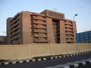
Specialized hospital at Abu Qir | |
 Abu Qir Location in Egypt | |
| Coordinates: 31°19′N 30°04′E / 31.317°N 30.067°E | |
| Country |
|
| Governorate | Alexandria Governorate |
| Time zone | EET (UTC+2) |
| • Summer (DST) | EEST (UTC+3) |
Abu Qir (Egyptian Arabic: ابو قير, Abu Qīr, [æbuˈ] or [æbo-ʔiːɾ]), formerly also spelled Abukir or Aboukir,[1] is a town on the Mediterranean coast of Egypt, near the ruins of ancient Canopus and 23 kilometers (14 mi) northeast of Alexandria by rail. It is located on Abu Qir Peninsula, with Abu Qir Bay to the east.
Name
The town's present name is Arabic for "Father Cyrus", an Egyptian Christian martyr.[1]
History
Near the village are many remains of ancient buildings, Egyptian, Greek and Roman. About 3 kilometers (2 mi) southeast of the village are the ruins of Canopus. A little farther east, the now-dry Canopic branch of the Nile entered the Mediterranean.[2]
Stretching eastward as far as the Rosetta mouth of the Nile is the spacious Abu Qir Bay (Khalīj Abū Qīr), where on 1 August 1798, Horatio Nelson fought the Battle of the Nile, often referred to as the "Battle of Aboukir Bay". The latter title is applied more properly to an engagement between the French expeditionary army and the Turks fought on 25 July the following year; see Battle of Abukir of 1799. Near Abū Qīr, on 8 March 1801, units of the British army commanded by Sir Ralph Abercromby landed from their transports in the face of a strenuous opposition from a French force entrenched on the beach.[2]
The town contains a castle that was used as a state prison by Muhammad Ali in the early 19th century.[2]
In 2000, an Italian archeologist discovered the remains of British officers, sailors, marines, women, and children on Nelson's Island, which lies in the bay.[3][4]
Climate
Köppen-Geiger climate classification system classifies its climate as hot desert (BWh), but it lies at the northern coast of Egypt, moderating its temperatures. Due to its proximity to Alexandria, it has a very similar climate. The wettest places in Egypt are Rafah, Alexandria, Abu Qir, Rosetta, Baltim, Kafr El Dawwar, Mersa Matruh.
| Climate data for Abu Qir | |||||||||||||
|---|---|---|---|---|---|---|---|---|---|---|---|---|---|
| Month | Jan | Feb | Mar | Apr | May | Jun | Jul | Aug | Sep | Oct | Nov | Dec | Year |
| Average high °C (°F) | 17.8 (64) |
18.4 (65.1) |
20.6 (69.1) |
23.5 (74.3) |
26.6 (79.9) |
29 (84) |
29.7 (85.5) |
30.6 (87.1) |
29.7 (85.5) |
28.2 (82.8) |
24.5 (76.1) |
20.1 (68.2) |
24.89 (76.8) |
| Daily mean °C (°F) | 13.7 (56.7) |
14.3 (57.7) |
16 (61) |
18.5 (65.3) |
21.6 (70.9) |
24.6 (76.3) |
25.9 (78.6) |
26.5 (79.7) |
25.5 (77.9) |
23.5 (74.3) |
20 (68) |
15.9 (60.6) |
20.5 (68.92) |
| Average low °C (°F) | 9.7 (49.5) |
10.2 (50.4) |
11.4 (52.5) |
13.6 (56.5) |
16.7 (62.1) |
20.3 (68.5) |
22.1 (71.8) |
22.5 (72.5) |
21.4 (70.5) |
18.9 (66) |
15.6 (60.1) |
11.7 (53.1) |
16.18 (61.13) |
| Average precipitation mm (inches) | 52 (2.05) |
31 (1.22) |
9 (0.35) |
2 (0.08) |
2 (0.08) |
0 (0) |
0 (0) |
0 (0) |
0 (0) |
7 (0.28) |
28 (1.1) |
52 (2.05) |
183 (7.21) |
| Source: Climate-Data.org[5] | |||||||||||||
See also
References
Citations
- 1 2 EB (1911b).
- 1 2 3 EB (1911a).
- ↑ "Women in Nelson's Navy" - BBC
- ↑ "Reburial for Nelson's comrades" - BBC
- ↑ "Climate: Abu Qir - Climate graph, Temperature graph, Climate table". Climate-Data.org. Retrieved 17 August 2013.
Bibliography
- "Canopus", Encyclopædia Britannica, 9th ed., Vol. V, New York: Charles Scribner's Sons, 1878, p. 23.
- "Aboukir", Encyclopædia Britannica, 11th ed., Vol. I, Cambridge: Cambridge University Press, 1911, p. 69.
- "Canopus", Encyclopædia Britannica, 11th ed., Vol. V, Cambridge: Cambridge University Press, 1911, p. 203.
External links
-
 "Aboukir". Collier's New Encyclopedia. 1921.