Acequia Madre de Valero (San Antonio)
|
Acequia Madre de Valero | |
 Acequia Madre de Valero  Acequia Madre de Valero | |
| Location | Bexar County, Texas |
|---|---|
| Coordinates | 29°25′18″N 98°29′21″W / 29.42167°N 98.48917°WCoordinates: 29°25′18″N 98°29′21″W / 29.42167°N 98.48917°W |
| Part of | Johann and Anna Heidgen House (#04000591) |
| NRHP Reference # | 04000591[1] |
| Significant dates | |
| Added to NRHP | June 9, 2004 |
| Designated RTHL | 1968 |
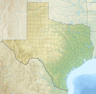
Acequia Madre de Valero is an 18th-century agricultural irrigation canal built by the Spanish and located in the Bexar County city of San Antonio in the U.S. state of Texas. When Martín de Alarcón founded San Antonio for Spain by establishing San Antonio de Valero Mission in 1718, Franciscan priest Antonio de Olivares[2] and the Payaya Indians dug Acequia Madre de Valero by hand. It was vital to the missions to be able to divert and control water from the San Antonio River, in order to grow crops and to supply water to the people in the area. This particular acequia was the beginning of a much wider acequia system. Acequia Madre de Valero ran from the area currently known as Brackenridge Park and southward to what is now Hemisfair Plaza and South Alamo Street.[3] Part of it that is not viewable by the public runs beneath the Menger Hotel. The acequia was restored in 1968 and that year was designated a Recorded Texas Historic Landmark.[4]
Acequia Madre de Valero was the initial phase of what became a 45-mile acequia network put in place by the Franciscan priests to provide water for the missions and their agricultural endeavors. The location of part of this acequia is adjacent to the Johann and Anna Heidgen House at 121 Star Street, and was a contributing factor in placing the house on the National Register of Historic Places listings in Bexar County, Texas in 2004. The acequia is lined with native limestone, a facet of Spanish engineering techniques. Some of the later stonework in the overall network was added by German immigrants. The full system involved placement of dams, canals and sluice gates. The complete network served residents of San Antonio until late in the 19th century.[5] The Texas Historical Commission placed the historic landmark plaque on a limestone block at the Hemisfair Plaza section of Acequia Madre de Valero.[6]
See also
- Antonio de Olivares
- Alamo Plaza Historic District
- Missión San Antonio de Valero (the Alamo)
- Main and Military Plazas Historic District
- Presidio San Antonio de Bexar
- Spanish Governor's Palace
- Spanish missions in Texas
References
- ↑ National Park Service (2008-04-15). "National Register Information System". National Register of Historic Places. National Park Service.
- ↑ De Zavala, Adina; Flores, Richard R (1996). History and Legends of the Alamo and Other Missions in and Around San Antonio. Arte Publico Press. pp. 3, 4. ISBN 978-1-55885-181-8.
- ↑ Dooley-Awbrey, Betty (2005). Why Stop?: A Guide to Texas Historical Roadside Markers. Taylor Trade Publishing. p. 453. ISBN 978-1-58979-243-2.
- ↑ "Acequia Madre de Valero". Recorded Texas Historic Landmarks. Texas Historical Commission. Retrieved October 11, 2012.
- ↑ "Johann and Anna Heidgen House". National Register of Historic Places. Texas Historical Commission. Retrieved October 12, 2012.
- ↑ "Acequia Madre de Valero (Main Irrigation Ditch of Valero Mission)". Waymarking. Retrieved October 12, 2012.