Agassiz, British Columbia
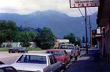
A view of the mountains from Agassiz, BC.
Agassiz is a small community located in the Eastern Fraser Valley region of British Columbia, Canada, about 97 kilometers east of Vancouver and immediately north of the city of Chilliwack.[1] The only town within the jurisdiction of the District Municipality of Kent, it contains the majority of Kent's population.
Climate
| Climate data for Agassiz, British Columbia | |||||||||||||
|---|---|---|---|---|---|---|---|---|---|---|---|---|---|
| Month | Jan | Feb | Mar | Apr | May | Jun | Jul | Aug | Sep | Oct | Nov | Dec | Year |
| Record high °C (°F) | 17.2 (63) |
21.7 (71.1) |
25.0 (77) |
32.2 (90) |
36.0 (96.8) |
36.7 (98.1) |
38.3 (100.9) |
39.4 (102.9) |
35.6 (96.1) |
28.3 (82.9) |
21.1 (70) |
17.2 (63) |
39.4 (102.9) |
| Average high °C (°F) | 6.2 (43.2) |
8.5 (47.3) |
11.6 (52.9) |
15.0 (59) |
18.5 (65.3) |
21.1 (70) |
24.0 (75.2) |
24.6 (76.3) |
21.3 (70.3) |
15.0 (59) |
8.9 (48) |
5.8 (42.4) |
15.0 (59) |
| Daily mean °C (°F) | 3.4 (38.1) |
5.1 (41.2) |
7.5 (45.5) |
10.4 (50.7) |
13.6 (56.5) |
16.2 (61.2) |
18.5 (65.3) |
18.7 (65.7) |
15.9 (60.6) |
11.0 (51.8) |
6.1 (43) |
3.2 (37.8) |
10.8 (51.4) |
| Average low °C (°F) | 0.5 (32.9) |
1.6 (34.9) |
3.4 (38.1) |
5.6 (42.1) |
8.8 (47.8) |
11.3 (52.3) |
12.8 (55) |
12.8 (55) |
10.3 (50.5) |
6.9 (44.4) |
3.2 (37.8) |
0.5 (32.9) |
6.5 (43.7) |
| Record low °C (°F) | −25.0 (−13) |
−24.4 (−11.9) |
−14.4 (6.1) |
−3.9 (25) |
−1.1 (30) |
1.7 (35.1) |
3.3 (37.9) |
1.7 (35.1) |
−1.1 (30) |
−8.5 (16.7) |
−19.0 (−2.2) |
−21.1 (−6) |
−25 (−13) |
| Average precipitation mm (inches) | 240.8 (9.48) |
142.1 (5.594) |
154.7 (6.091) |
125.9 (4.957) |
103.0 (4.055) |
92.2 (3.63) |
66.6 (2.622) |
58.2 (2.291) |
87.6 (3.449) |
191.7 (7.547) |
285.0 (11.22) |
206.1 (8.114) |
1,754.1 (69.059) |
| Average rainfall mm (inches) | 220.8 (8.693) |
131.1 (5.161) |
148.8 (5.858) |
125.5 (4.941) |
103.0 (4.055) |
92.2 (3.63) |
66.6 (2.622) |
58.2 (2.291) |
87.6 (3.449) |
191.6 (7.543) |
275.8 (10.858) |
187.7 (7.39) |
1,688.9 (66.491) |
| Average snowfall cm (inches) | 20.3 (7.99) |
12.5 (4.92) |
5.8 (2.28) |
0.4 (0.16) |
0 (0) |
0 (0) |
0 (0) |
0 (0) |
0 (0) |
0.2 (0.08) |
9.2 (3.62) |
19.0 (7.48) |
67.4 (26.53) |
| Average precipitation days (≥ 0.2 mm) | 19.2 | 17.3 | 19.9 | 17.8 | 17.1 | 15.0 | 10.4 | 10.1 | 11.7 | 17.1 | 21.3 | 20.0 | 196.9 |
| Average rainy days (≥ 0.2 mm) | 16.8 | 15.8 | 19.6 | 17.8 | 17.1 | 15.0 | 10.4 | 10.1 | 11.7 | 17.1 | 20.7 | 18.1 | 190.1 |
| Average snowy days (≥ 0.2 cm) | 4.6 | 2.8 | 1.0 | 0.2 | 0 | 0 | 0 | 0 | 0 | 0.07 | 1.3 | 3.9 | 13.87 |
| Mean monthly sunshine hours | 57.8 | 85.7 | 127.7 | 163.9 | 194.2 | 195.6 | 255.8 | 242.2 | 196.8 | 122.2 | 60.2 | 53.6 | 1,755.6 |
| Source: Environment Canada[2] | |||||||||||||
Gallery
-
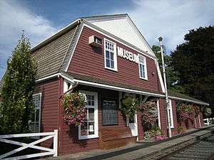
The Agassiz-Harrison Museum
-
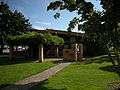
District of Kent District Hall and Public Library, Agassiz, BC.
References
- ↑ "Agassiz (Community)". BC Geographical Names.
- ↑ "Canadian Climate Normals 1981-2010 at station AGASSIZ CDA". Environment Canada. 2013-07-01. Retrieved 2014-01-02.
| Wikimedia Commons has media related to Agassiz, British Columbia. |
| Subdivisions | 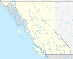 | |
|---|---|---|
| Communities | ||
| Metro areas and agglomerations | ||
| Detached communities within district municipalities |
| |
| ||
Coordinates: 49°14′00″N 121°46′00″W / 49.23333°N 121.76667°W
This article is issued from Wikipedia - version of the 12/7/2015. The text is available under the Creative Commons Attribution/Share Alike but additional terms may apply for the media files.