Agioi Anargyroi
| Agioi Anargyroi Άγιοι Ανάργυροι | |
|---|---|
 Agioi Anargyroi | |
|
Location within Athens 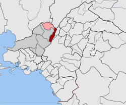 | |
| Coordinates: 38°1.6′N 23°43.1′E / 38.0267°N 23.7183°ECoordinates: 38°1.6′N 23°43.1′E / 38.0267°N 23.7183°E | |
| Country | Greece |
| Administrative region | Attica |
| Regional unit | West Athens |
| Municipality | Agioi Anargyroi-Kamatero |
| • Municipal unit | 3.200 km2 (1.236 sq mi) |
| Elevation | 70 m (230 ft) |
| Population (2011)[1] | |
| • Municipal unit | 34,168 |
| • Municipal unit density | 11,000/km2 (28,000/sq mi) |
| Time zone | EET (UTC+2) |
| • Summer (DST) | EEST (UTC+3) |
| Postal code | 135 xx |
| Area code(s) | 210 |
| Vehicle registration | IB |
| Website | www.agan.gov.gr |
Agioi Anargyroi (Greek: Άγιοι Ανάργυροι) is a suburb in the north-central part of the Athens agglomeration, Greece. It takes its name from the "Holy Unmercenaries": saints who received no payment for their medical services. Since the 2011 local government reform it is part of the municipality Agioi Anargyroi-Kamatero, of which it is the seat and a municipal unit.[2]
Geography

Agioi Anargyroi is located 5 km (3 mi) north of Athens city centre. The municipal unit has an area of 3.200 km2.[3] Its built-up area is continuous with that of Athens and the neighbouring suburbs Peristeri, Ilion, Kamatero, Acharnes, Nea Filadelfeia and Nea Chalkidona. Motorway 1 (Athens–Thessaloniki) passes east of the town. Agioi Anargyroi has a station on the Athens–Thessaloniki railway. The old metric Piraeus–Patras railway passes through the town as well.
Historical population
| Year | Population |
|---|---|
| 1971 | 26,094 |
| 1981 | 30,320 |
| 1991 | 30,739 |
| 2001 | 32,957 |
| 2011 | 34,168 |
International relations
Agioi Anargyroi is twinned with:
References
- Notes
- ↑ "Απογραφή Πληθυσμού - Κατοικιών 2011. ΜΟΝΙΜΟΣ Πληθυσμός" (in Greek). Hellenic Statistical Authority.
- ↑ Kallikratis law Greece Ministry of Interior (Greek)
- ↑ "Population & housing census 2001 (incl. area and average elevation)" (PDF) (in Greek). National Statistical Service of Greece. Archived from the original (PDF) on 2015-09-21.
- ↑ "Opole Official Website - Twin Towns".

 (in English and Polish) © 2007-2009 Urząd Miasta Opola. Retrieved 2009-06-18.
External links
- Municipality of Agioi Anargyroi (Greek)
- Information on Agioi Anargyroi (Greek)
 |
Kamatero | Acharnes | Nea Filadelfeia | |
| Ilion | |
Nea Chalkidona | ||
| ||||
| | ||||
| Ilion | Peristeri | Athens |