Aileu District
| Aileu | ||
|---|---|---|
| District | ||
|
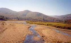
River in Aileu | ||
| ||
 Map of East Timor highlighting Aileu District | ||
| Coordinates: 8°43′S 125°34′E / 8.717°S 125.567°ECoordinates: 8°43′S 125°34′E / 8.717°S 125.567°E | ||
| Country |
| |
| Capital | Aileu | |
| Subdistricts | Aileu, Laulara, Lequidoe, Remexio | |
| Area | ||
| • Total | 737 km2 (285 sq mi) | |
| Area rank | 9th | |
| Population (2015) | ||
| • Total | 48,554 | |
| • Rank | 12th | |
| • Density | 66/km2 (170/sq mi) | |
| • Density rank | 8th | |
| Households | ||
| • Total | 7,745 (as of 2004) | |
| • Rank | 13th | |
| Time zone | UTC+9 | |
| ISO 3166 code | TL-AL | |

Aileu is an administrative district of East Timor. It has a population of 44,325 (Census 2010) and an area of 737 km². The capital of the district is also named Aileu. The subdistricts are Aileu, Laulara, Lequidoe and Remexio.
Aileu is in the northwestern part of East Timor and is one of only two landlocked districts, the other being Ermera. It borders Dili to the north, Manatuto to the east, Manufahi to the southeast, Ainaro to the south, Ermera to the west, and Liquiçá to the northwest. It was formerly part of the district of Dili but was split in the final years of Portuguese administration.
Development
Possibly due to its close proximity to Dili and relatively easy access, the Aileu District is the focus on various development programmes from NGOs, including WaterAid,[1] World Vision[2] and Plan International.[3] The Hume City Council and Moreland City Council in Melbourne Australia, have established a friendship relationship with the Aileu Distrist, called "Friends of Aileu".[4]
Administrative divisions

- Aileu Subdistrict (place of capital)
- Laulara Subdistrict
- Lequidoe Subdistrict
- Remexio Subdistrict
References
- ↑ http://www.wateraid.org/australia/what_we_do/where_we_work/timorleste/4211.asp
- ↑ http://timorleste.wvasiapacific.org/index.php?option=com_content&view=section&id=13&Itemid=95
- ↑ http://www.plan.org.au/ourwork/asia/easttimor/water-sanitation-hygeine
- ↑ http://www.moreland.vic.gov.au/community-services/friendship-cities/friends-of-aileu/about-friends-of-aileu.html