Aileu
| Aileu | |
|---|---|
 | |
 | |
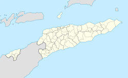 Aileu Location in East Timor | |
| Coordinates: 8°43′S 125°34′E / 8.717°S 125.567°ECoordinates: 8°43′S 125°34′E / 8.717°S 125.567°E | |
| Country |
|
| District | Aileu District |
| Subdistricts | Aileu Subdistrict |
| Suco | Seloi Malere, Liurai |
| Area | |
| • Total | 251.48 km2 (97.10 sq mi) |
| Elevation | 1,182 m (3,878 ft) |
| Population (2015) | |
| • Total | 2,788 |
| • Density | 11/km2 (29/sq mi) |
| • Ethnicities | Tetum, Mambai |
| • Religions | Catholic, minorities of protestants and aninism |
| Climate | Am |
Aileu is the main township in Aileu Subdistrict, Aileu District, East Timor. It is located 47 km southwest of Dili, the national capital, and has a population of 2,788 (2010).[1]
In Portuguese Timor, the city was known as Vila General Carmona, after the Portuguese dictator António Óscar Carmona.
References
| Wikimedia Commons has media related to Aileu. |
Capitals of Municipalities of East Timor | ||
|---|---|---|
This article is issued from Wikipedia - version of the 6/18/2016. The text is available under the Creative Commons Attribution/Share Alike but additional terms may apply for the media files.