Aleksandrów County
| Aleksandrów County Powiat aleksandrowski | |||
|---|---|---|---|
| County | |||
| |||
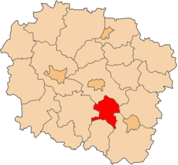 Location within the voivodeship | |||
| Coordinates (Aleksandrów Kujawski): 52°52′N 18°42′E / 52.867°N 18.700°ECoordinates: 52°52′N 18°42′E / 52.867°N 18.700°E | |||
| Country |
| ||
| Voivodeship | Kuyavian-Pomeranian | ||
| Seat | Aleksandrów Kujawski | ||
| Gminas | |||
| Area | |||
| • Total | 475.61 km2 (183.63 sq mi) | ||
| Population (2010) | |||
| • Total | 55,352 | ||
| • Density | 120/km2 (300/sq mi) | ||
| • Urban | 25,226 | ||
| • Rural | 29,969 | ||
| Car plates | CAL | ||
| Website | http://www.aleksandrow.pl/ | ||

Aleksandrów County (Polish: powiat aleksandrowski) is a unit of territorial administration and local government (powiat) in Kuyavian-Pomeranian Voivodeship, north-central Poland. It came into being on January 1, 1999, as a result of the Polish local government reforms passed in 1998. Its administrative seat and largest town is Aleksandrów Kujawski, which lies 20 km (12 mi) south of Toruń and 55 km (34 mi) south-east of Bydgoszcz. The county also contains the towns of Ciechocinek, lying 6 km (4 mi) east of Aleksandrów Kujawski, and Nieszawa, 14 km (9 mi) east of Aleksandrów Kujawski.
The county covers an area of 475.61 square kilometres (183.6 sq mi). As of 2010 its total population is 55,352, out of which the population of Aleksandrów Kujawski is 12,359, that of Ciechocinek is 10,855, that of Nieszawa is 2,012, and the rural population is 29,969.
Neighbouring counties
Aleksandrów County is bordered by Toruń County to the north, Lipno County to the east, Włocławek County to the south-east, Radziejów County to the south and Inowrocław County to the west.
Administrative division
The county is subdivided into nine gminas (three urban and six rural). These are listed in the following table, in descending order of population.
| Gmina | Type | Area (km²) |
Population (2006) |
Seat |
| Aleksandrów Kujawski | urban | 7.2 | 12,359 | |
| Gmina Aleksandrów Kujawski | rural | 131.6 | 10,874 | Aleksandrów Kujawski * |
| Ciechocinek | urban | 15.3 | 10,855 | |
| Gmina Bądkowo | rural | 79.7 | 4,582 | Bądkowo |
| Gmina Waganiec | rural | 54.6 | 4,400 | Waganiec |
| Gmina Zakrzewo | rural | 76.1 | 3,661 | Zakrzewo |
| Gmina Koneck | rural | 68.1 | 3,368 | Koneck |
| Gmina Raciążek | rural | 32.9 | 3,084 | Raciążek |
| Nieszawa | urban | 9.8 | 2,012 | |
| * seat not part of the gmina | ||||
References
| Urban gminas |  | |
|---|---|---|
| Rural gminas | ||
| City counties |  | |
|---|---|---|
| Land counties | ||