Prathai District
| Prathai ประทาย | |
|---|---|
| Amphoe | |
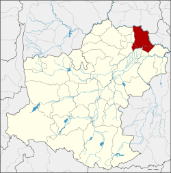 Amphoe location in Nakhon Ratchasima Province | |
| Coordinates: 15°32′0″N 102°43′22″E / 15.53333°N 102.72278°ECoordinates: 15°32′0″N 102°43′22″E / 15.53333°N 102.72278°E | |
| Country |
|
| Province | Nakhon Ratchasima |
| Amphoe established | 1961 |
| Area | |
| • Total | 600.6 km2 (231.9 sq mi) |
| Population (2015) | |
| • Total | 77,927 |
| • Density | 127.7/km2 (331/sq mi) |
| Time zone | THA (UTC+7) |
| Postal code | 30180 |
| Geocode | 3013 |
Prathai (Thai: ประทาย) is a district (amphoe) in the northeastern part of Nakhon Ratchasima Province, northeastern Thailand.
History
Prathai village was built in Khmer era. King Jayavarman II set his camp in the area when he expanded his power to the west. After his reign, Prathai was deserted. It became a community again in Sukhothai era.
Prathai in Khmer means camp.
Tambon Prathai was separated from Bua Yai district to create a minor district (King Amphoe) on January 1, 1961[1] and officially upgraded to be full district in 1963.[2]
Geography
Neighboring districts are (from the north clockwise) Phon and Nong Song Hong of Khon Kaen Province, Ban Mai Chaiyaphot of Buriram Province, and Mueang Yang, Chum Phuang, Phimai, Non Daeng, Sida and Bua Lai of Nakhon Ratchasima Province.
Administration
Central administration
The district Prathai is subdivided into 13 subdistricts (Tambon), which are further subdivided into 151 administrative villages (Muban).
| No. | Name | Thai | Villages | Pop.[3] |
|---|---|---|---|---|
| 1. | Prathai | ประทาย | 17 | 10,191 |
| 3. | Krathum Rai | กระทุ่มราย | 17 | 7,285 |
| 4. | Wang Mai Daeng | วังไม้แดง | 11 | 6,310 |
| 6. | Talat Sai | ตลาดไทร | 13 | 6,024 |
| 7. | Nong Phluang | หนองพลวง | 12 | 5,695 |
| 8. | Nong Khai | หนองค่าย | 14 | 5,083 |
| 9. | Han Huai Sai | หันห้วยทราย | 9 | 5,576 |
| 10. | Don Man | ดอนมัน | 10 | 5,393 |
| 13. | Nang Ram | นางรำ | 13 | 5,829 |
| 14. | Non Phet | โนนเพ็ด | 11 | 5,789 |
| 15. | Thung Sawang | ทุ่งสว่าง | 8 | 4,669 |
| 17. | Khok Klang | โคกกลาง | 9 | 6,030 |
| 18. | Mueang Don | เมืองโดน | 7 | 4,053 |
Missing numbers are tambon which now form Non Daeng district.
Local administration
There is one subdistrict municipality (Thesaban Tambon) in the district:
- Prathai (Thai: เทศบาลตำบลประทาย) consisting of parts of the subdistrict Prathai.
There are 13 subdistrict administrative organizations (SAO) in the district:
- Prathai (Thai: องค์การบริหารส่วนตำบลประทาย) consisting of parts of the subdistrict Prathai.
- Krathum Rai (Thai: องค์การบริหารส่วนตำบลกระทุ่มราย) consisting of the complete subdistrict Krathum Rai.
- Wang Mai Daeng (Thai: องค์การบริหารส่วนตำบลวังไม้แดง) consisting of the complete subdistrict Wang Mai Daeng.
- Talat Sai (Thai: องค์การบริหารส่วนตำบลตลาดไทร) consisting of the complete subdistrict Talat Sai.
- Nong Phluang (Thai: องค์การบริหารส่วนตำบลหนองพลวง) consisting of the complete subdistrict Nong Phluang.
- Nong Khai (Thai: องค์การบริหารส่วนตำบลหนองค่าย) consisting of the complete subdistrict Nong Khai.
- Han Huai Sai (Thai: องค์การบริหารส่วนตำบลหันห้วยทราย) consisting of the complete subdistrict Han Huai Sai.
- Don Man (Thai: องค์การบริหารส่วนตำบลดอนมัน) consisting of the complete subdistrict Don Man.
- Nang Ram (Thai: องค์การบริหารส่วนตำบลนางรำ) consisting of the complete subdistrict Nang Ram.
- Non Phet (Thai: องค์การบริหารส่วนตำบลโนนเพ็ด) consisting of the complete subdistrict Non Phet.
- Thung Sawang (Thai: องค์การบริหารส่วนตำบลทุ่งสว่าง) consisting of the complete subdistrict Thung Sawang.
- Khok Klang (Thai: องค์การบริหารส่วนตำบลโคกกลาง) consisting of the complete subdistrict Khok Klang.
- Mueang Don (Thai: องค์การบริหารส่วนตำบลเมืองโดน) consisting of the complete subdistrict Mueang Don.
References
- ↑ ประกาศกระทรวงมหาดไทย เรื่อง ยกฐานะตำบลขึ้นเป็นกิ่งอำเภอ (PDF). Royal Gazette (in Thai). 74 (76 ง): 2257–2258. 1957-09-17.
- ↑ พระราชกฤษฎีกาตั้งอำเภอบ่อพลอย อำเภอไทรโยค อำเภอหนองเรือ อำเภอหนองสองห้อง อำเภอประทาย อำเภอห้วยแถลง อำเภอละหานทราย อำเภอกุยบุรี อำเภอตาพระยา อำเภอหนองไผ่ อำเภอนาเชือก อำเภอวัดเพลง อำเภอพนัสนิคม อำเภอภูกระดึง อำเภอปรางค์กู่ อำเภอท่าช้าง อำเภอบ้านด่านลานหอย อำเภอบ้านดง อำเภอสว่างอารมณ์ และอำเภอกุดชุม พ.ศ. ๒๕๐๖ (PDF). Royal Gazette (in Thai). 80 (72 ก): 362. 1963-07-16.
- ↑ "Population statistics 2015" (in Thai). Department of Provincial Administration. Retrieved 2016-03-25.
External links
- amphoe.com (Thai)