Anavra
| Anavra Ανάβρα | |
|---|---|
 Anavra | |
|
Location within the regional unit 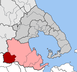 | |
| Coordinates: 39°4′N 22°32′E / 39.067°N 22.533°ECoordinates: 39°4′N 22°32′E / 39.067°N 22.533°E | |
| Country | Greece |
| Administrative region | Thessaly |
| Regional unit | Magnesia |
| Municipality | Almyros |
| • Municipal unit | 121.9 km2 (47.1 sq mi) |
| Elevation | 780 m (2,560 ft) |
| Population (2011)[1] | |
| • Municipal unit | 584 |
| • Municipal unit density | 4.8/km2 (12/sq mi) |
| Time zone | EET (UTC+2) |
| • Summer (DST) | EEST (UTC+3) |
| Postal code | 35 010 |
| Area code(s) | +30 22320 |
Anavra (Greek: Ανάβρα) is a village and a former community in Magnesia, Thessaly, Greece. Since the 2011 local government reform, it has been part of the municipality Almyros, of which it is a municipal unit.[2] The municipal unit has an area of 121.859 km2.[3] According to the census of 2011, the population of Anavra was 584 citizens. The village of Anavra is located on the west side of Mount Othrys, at a height of 900 metres (3,000 ft) above sea level, 72 kilometres (45 mi) from Magnesia's administrative center of Volos and close to the border of Phthiotis. The Enipeas river, which is a tributary of the Pineios, starts at the springs of Anavra and passes through the village for two kilometres.
According to mythology, Anavra is connected with livestock activities. Almost all the inhabitants are employed in farming and herding.
Economy
In the 1970's mules were the only form of transport available in Anavra, and the nearest school, in Lamia, was a 6 hour ride away.[4] Since the 1990's the village has been transformed by mayor Dimitris Tsoukalas, who successfully sought EU development funding.[4]
Today, Anavra has among the highest GDP per capita of any settlement in Greece[5] and the rest of the EU with typical incomes ranging from 30,000 to 100,000 euros.[6] The village has an average household income of €70,000.[4]
Anavra has been recognized as a model of sustainable development.[7] The town produces its own electricity by 20 wind-powered generators.[5] Surplus electrical power is sold. A hydroelectric plant is scheduled for construction, and a biomass facility is being planned which will supply heat and hot water from animal manure and woodchips. The plan calls for all homes and buildings in the town to be connected to this heat/hot water network.
Plans are being proposed for the creation of a winter ski centre on the slopes of Mount Othrys and its highest peak, Gerakovouni (1726 m), west of the village.
Sites of Interest
- Saint Dimitrios church
- The Folkore Museum of Farming Life.
- The waterfalls of Enipeas
- Othry mountain and its rich flora
General information
- Community office, Tel: 22320 91382
- Communal Library, Tel: 22320 91210
- Folklore Museum of Farming Life, Tel: 22320 91210
References
- ↑ "Απογραφή Πληθυσμού - Κατοικιών 2011. ΜΟΝΙΜΟΣ Πληθυσμός" (in Greek). Hellenic Statistical Authority.
- ↑ (Greek) Kallikratis law Greece Ministry of Interior.
- ↑ "Population & housing census 2001 (incl. area and average elevation)" (PDF) (in Greek). National Statistical Service of Greece.
- 1 2 3 Miller, Joe (2 July 2015). "Why Greece's richest village is voting 'yes'". BBC News. British Broadcasting Corporation. Retrieved 2015-07-02.
- 1 2 Marloes de Koning (3 May 2012). "De beste jaren van Anavra". NRC Handelsblad (in Dutch). p. 30.
- ↑ Ανάβρα: ο εκσυγχρονισμός μιας ορεινής κοινότητας (in Greek). greekscapes.gr. Archived from the original on 4 May 2012.
- ↑ Giannarou, Lina (20 March 2009). "Anavra - A Greek Model of Sustainable Development" (PDF). Athens Plus. I Kathimerini. Archived from the original (PDF) on 2 July 2015.
Further reading
- (Greek) Καραλή, Μ. (επιμ.) (1994) Πρακτικά Συνεδρίου "Το παρελθόν, το παρόν και το μέλλον της Ανάβρας (Γούρας)", 31 Ιουλίου – 1 Αυγούστου 1993, Αθήνα: Κοινότητα Ανάβρας Μαγνησίας.
- (Greek) Καραλή, Μ. (2002) "Κοινότητα Ανάβρας Αλμυρού Μαγνησίας. Ένα πείραμα τοπικής ανάπτυξης με πρωτοβουλία της Τοπικής Αυτοδιοίκησης", Γεωγραφίες, 4, σσ. 123-129.
- (Greek) Μηλιώνης, π. Α. (2006) Η Ανάβρα (Γούρα) της Όθρυος, Ανάβρα Αλμυρού Μαγνησίας: Κοινότητα Ανάβρας Αλμυρού Μαγνησίας.
- (Greek) Περιοδικό "Κ" της Καθημερινής (2009) "Αφιέρωμα στην Ανάβρα", 12/03.
External links
- Official Website (in Greek and English)
- Official Website of the Environmental and Cultural Park of Anavra "Goura" (in Greek and English)
- Anavra-Zo (in Greek)