Arak, Iran
| Arak اراک, Arāk | ||
|---|---|---|
| city | ||
|
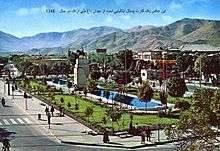
Clockwise from top: Bakhtyari Bridge, Valiasr Square, Senjan, City Park, and the old bazaar. | ||
| ||
 Arak | ||
| Coordinates: 34°05′30″N 49°41′21″E / 34.09167°N 49.68917°ECoordinates: 34°05′30″N 49°41′21″E / 34.09167°N 49.68917°E | ||
| Country |
| |
| Province | Markazi | |
| County | Arak | |
| District | Central | |
| Government | ||
| • Mayor | Mohammad Ebrahim Abbasi | |
| Elevation | 1,718 m (5,636 ft) | |
| Population (2011) | ||
| • Total | 526,182[1][2] | |
| Time zone | IRST (UTC+3:30) | |
| • Summer (DST) | IRDT (UTC+4:30) | |
| Area code(s) | 086 | |
| Website | www.arak.ir | |

Arak (Persian: اراک, Arāk; IPA: [æˈɾɒːk]), also known as Soltan Abad (سلطان آباد, Soltān Ābād),[3] is the capital of Markazi Province, Iran. At the 2011 census, its population was 526,182, in 160,761 families.[1][2]
A major industrial city, Arak hosts several industrial factories inside and within few kilometers outside of the city, including the factory of Machine Sazi Arak and the Iranian Aluminium Company. These factories produce nearly half of the needs of the country in steel, petrochemical, and locomotive industries.
As an industrial city in a developing country, Arak is subject to the issue of air pollution.
Etymology
Arāk
The term Arāk remains from a name given to the region since the medieval period. It derives from Arabic al-ʿIrāq, meaning "edge",[4] itself derived possibly from Akkadian Uruk (Hebrew: אֶרֶךְ, Erech).
During the Seljuk era, a region comprising the whole territory of Media (northwestern Iran) and the lower part of Mesopotamia was referred to as Iraq; with the Median part called ʿErāq-e ʿAǰam ("Iraq of the Ajam"), and the Mesopotamian part called ʿErāq-e ʿArab ("Iraq of the Arab").[5]
Soltān Ābād
The term Soltān Ābād is a Persian compound word.
Soltān, deriving from Arabic sulṭān ("power", "authority"), is a Near Eastern noble title given to a powerful governor. Modern Persian ābād, meaning "settlement" or "abode", derives from Middle Persian āpāt ("populous"). However, according to linguist Sasha Lubotsky, the Persian term ābād might derive from Proto-Iranian *āpāta ("protected"), rooting from Proto-Indo-European *peh₂- ("to protect").
History
Originally named Soltan Abad, the modern-day city of Arak was founded in 1808 by Yusef Khan e Gorji,[6] a pro-Iranian warlord of Georgian origin who was given refuge by Qajar ruler Agha Mohammad Khan following a territorial dispute with his cousins, who were supported by Russian empress Catherine the Great.
The modern-day city of Arak was founded during the Qajar era. Named Soltan Abad at the time, it was founded in 1808 by Yusef Khan e Gorji,[7] a pro-Iranian warlord of Georgian origin who was given refuge by Qajar ruler Agha Mohammad Khan following a territorial dispute with his cousins, who were supported by Russian empress Catherine the Great.
Between 1795 and 1797, Yusef Khan e Gorji, renamed Yusef Khan e Sepahdar by the Qajar ruler, settled his army in the fertile but poorly-controlled territory that would become the modern-day Arak. Hostile tribes in the region had operated autonomously from the Qajar rule. With the Shah's approval, Yusef Khan diverted the main river to drive out the hostiles and build the war fortress of Soltan Abad to act as a buffer.
According to early modern historians, Yusef Khan built the city with the aid of effluents. Until 1892, the town remained a military base and fortress. The fortress of Soltan Abad had a thick wall surrounded by 7-meter-deep moats. Eight towers were constructed around the town and the governmental building was established in its northern part.
In 1891, shops, gardens, and government buildings of Soltan Abad were repaired by the order of deputy governor Mirza Hasan (Etemad os Saltane). Large parts of the city were formerly annexed as personal property to the pre-existing army commanders, and were then ultimately turned over to the state around 1918–1922.
Beginning by the last quarter of the 19th century, the city achieved major developments in carpet industry, and eventually became Iran's most important center of carpet production for export markets, continuing up until at least 1940.[8]
Under the reign of Reza Shah of the Pahlavi dynasty, the city was renamed Arak. Modern factories for vegetable oil, soap, sugar beet, and wool industries were established within the city. Arak also became an important station for the Trans-Iranian Railway, a major railway project directed by Reza Shah which was completed in 1938.
In 1972, two major state-owned enterprises were established in the city, including an aluminum smelter and a heavy engineering plant. The aluminum smelter was built under the Regional Cooperation for Development project of the Central Treaty Organization, in cooperation with the company of Reynolds and Reynolds. The engineering plant was processed with equipment and technical advice from the Soviets, in return of gas sales to the Soviet Union.
The city officially became a metropolis on April 6, 2013, after the merger with Karahrud and Senjan.[2][9]
Geography
Arak is surrounded by mountains in the south, west, and east, and its average altitude is about 1750m above sea level. It is located 260 km from the city of Tehran, and is in the vicinity of the cities of Qom and Isfahan.
-
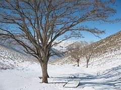
The Gerdoo Valley in winter.
-
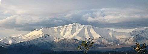
Sefidkhani Mountain, located to the west of Arak.
-

Meyqan Lagoon, 15 km northeast of Arak.
-
_-_panoramio.jpg)
Sunset in Meyqan Lagoon.
Climate
Arak has a continental climate (Köppen climate classification Dsa) that is, in general, relatively cold and dry.
The weather of the city is hot and dry in summer, windy and cool in autumn, cold and snowy in winter, and mild in spring. Its maximum temperature may raise up to 35 degrees Celsius in summer and fall to below -25 degrees Celsius in winter. The average rainfall is around 350mm and the annual relative humidity is 46%.
| Climate data for Arak | |||||||||||||
|---|---|---|---|---|---|---|---|---|---|---|---|---|---|
| Month | Jan | Feb | Mar | Apr | May | Jun | Jul | Aug | Sep | Oct | Nov | Dec | Year |
| Record high °C (°F) | 17.0 (62.6) |
21.0 (69.8) |
25.2 (77.4) |
29.0 (84.2) |
35.0 (95) |
41.0 (105.8) |
44.0 (111.2) |
41.0 (105.8) |
38.0 (100.4) |
31.0 (87.8) |
24.0 (75.2) |
20.0 (68) |
44 (111.2) |
| Average high °C (°F) | 4.2 (39.6) |
6.8 (44.2) |
13.5 (56.3) |
19.6 (67.3) |
25.6 (78.1) |
32.6 (90.7) |
35.8 (96.4) |
34.9 (94.8) |
30.8 (87.4) |
23.1 (73.6) |
14.8 (58.6) |
7.6 (45.7) |
20.78 (69.39) |
| Daily mean °C (°F) | −1.3 (29.7) |
1.0 (33.8) |
7.3 (45.1) |
13.1 (55.6) |
18.4 (65.1) |
24.4 (75.9) |
27.5 (81.5) |
26.3 (79.3) |
21.9 (71.4) |
15.2 (59.4) |
8.0 (46.4) |
2.0 (35.6) |
13.65 (56.57) |
| Average low °C (°F) | −5.7 (21.7) |
−3.8 (25.2) |
2.0 (35.6) |
7.0 (44.6) |
11.0 (51.8) |
15.3 (59.5) |
18.8 (65.8) |
17.5 (63.5) |
13.0 (55.4) |
7.8 (46) |
2.6 (36.7) |
−2.2 (28) |
6.94 (44.48) |
| Record low °C (°F) | −28 (−18) |
−30.5 (−22.9) |
−13 (9) |
−4.0 (24.8) |
0.0 (32) |
4.0 (39.2) |
12.0 (53.6) |
10.0 (50) |
2.0 (35.6) |
−4.0 (24.8) |
−7 (19) |
−23 (−9) |
−30.5 (−22.9) |
| Average precipitation mm (inches) | 54.7 (2.154) |
47.6 (1.874) |
53.1 (2.091) |
53.4 (2.102) |
31.9 (1.256) |
1.5 (0.059) |
0.6 (0.024) |
1.1 (0.043) |
0.7 (0.028) |
18.5 (0.728) |
31.6 (1.244) |
51.0 (2.008) |
345.7 (13.611) |
| Average rainy days | 10.8 | 9.8 | 11.4 | 9.4 | 7.1 | 1.1 | 0.9 | 0.6 | 0.6 | 4.3 | 6.1 | 8.9 | 71 |
| Average snowy days | 7.6 | 6.4 | 3.2 | 0.5 | 0 | 0 | 0 | 0 | 0 | 0.1 | 0.7 | 4.6 | 23.1 |
| Average relative humidity (%) | 72 | 67 | 55 | 46 | 40 | 28 | 27 | 27 | 27 | 40 | 56 | 67 | 46 |
| Mean monthly sunshine hours | 150.8 | 160.6 | 196.0 | 222.1 | 287.5 | 350.4 | 338.3 | 329.4 | 305.1 | 262.3 | 188.5 | 160.8 | 2,951.8 |
| Source: NOAA (1961-1990) [10] | |||||||||||||
-

A snowy night in Arak.
-
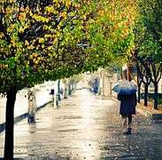
A rainy day in Arak.
-
.jpg)
The Senjan district in summer.
-
Gardens in Senjan.
-

The City Park of Arak in autumn.
Transport
Airport
Arak is served by the International Airport of Arak, which is located north of the city. The airport was opened in 1938, and is one of the oldest airports of Iran.
Rail
The railway system of Arak was connected to the Iranian Railways in 1935. Destinations stretch directly from Bandar-e-Shapur in the southwestern Iran to Bandar-e-Torkman under the Caspian Sea.
Public transportation
Buses provide the bulk of the local public transport in Arak.
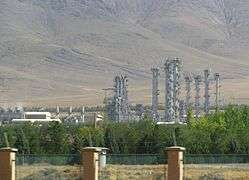
Industry
Arak is one of the main industrial cities of Iran, possessing many plants for heavy industries, especially for metal and machinery industries. The following are a number of industrial factories based in Arak.
- Machine Sazi Arak
- Azarab Industries Company
- Wagon Pars (train manufacturer)
- Iranian Aluminium Company
- HEPCO (road construction equipment)
- Navard Aluminium
- Combine Manufacturing Company of Iran
- Shazand Oil Refinery Company
- Shazand Petrochemical Company
- Heavy Water Production Plant of Arak
-

Locomotive production at Wagon Pars.
-

Siemens locomotives of Wagon Pars.
-
The Heavy Water Production Plant of Arak.
-
.JPG)
Eastern side of the Shazand Oil Refinery company.
-
.jpg)
HEPCO grader roadworks.
Agriculture and handicrafts
The main agricultural products of the city are grain, barley, and fruits including grape, apple, walnut, and almond. Arak also exports hand-knotted carpets which are referred to as Sarouk rugs. Saruq is a small village outside of Arak, and its name is used in order to prevent confusion with rug from the modern-day country of Iraq.
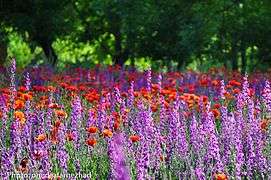
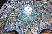
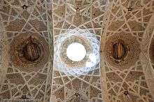
Main sites
.jpg)
Parks and gardens
- Nezam Lashgar Garden (Garden of Esmaeili)
- City Park
- Amir Kabir Park
- Jangali Park
- Kelale Mountain Park
- Arak Zoo
- Madar Park
Museums
- Soltan Abad Museum
- Four Seasons Bathroom
- Museum of Artifacts (Hassan Pour Museum)
- Museum of Famous Figures (The Hall of Fame of Arak)
- Grand Museum of Arak
Sports Complexes
- Amir Kabir Entertainment and Sports Complex
- Tufan Entertainment and Sports Complex
- Shahin Horse Riding Complex
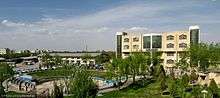
Universities
- Arak University
- Arak University of Medical Sciences
- Amirkabir University of Technology
- Arak University of Technology
- Azad University of Arak
- Payam-e-Noor University of Arak
- Kharazmi University of Arak
Other
- The old bazaar of Arak
- Doab Bridge (built over the Shara River)
- Mostowfi Mansion
- Gerdoo Valley (known for its walnut trees and ranges)
Notable people

Statesmen and politicians:
- Sharaf Khan Bidlisi (1543-ca. 1600), Kurdish historian and prince of Bitlis, was born in Karahrūd, Arak.[11]
- Ghaem Magham Farahani (1779–1835), a former Prime Minister of Iran, was born in Farahan District, Arak.
- Amir Kabir (1807–1852), a former Prime Minister of Iran, was born in Hezaveh District, Arak.
- Mohammad Mosaddegh (1882–1967), a former Prime Minister of Iran, was born in Tehran. His father was from Ashtiyan, northeastern Arak.
- Morteza-Qoli Bayat (1890–1958), a former Prime Minister of Iran (1944–1945).
- Ata'ollah Mohajerani (1954–), one of the ministers of the cabinet of Mohammad Khatami.
Literary, painting, and photography figures:
- Parvin E'tesami (1907–1941), the Iranian poet, was born in Tabriz. Her father was from Ashtiyan, northeastern Arak.
- Behjat Sadr (1924–2009), an eminent Iranian painter.
- Jahangir Razmi (1947–), the 1980 Pulitzer Prize winner (photographer).
- Kader Abdolah (1954–), an Iranian-Dutch poet laureate.
Sportsmen:
- Mansour Bahrami (1956–), an Iranian tennis player.
- Mehdi Mahdavikia (1977–), a famous Iranian football player.
Scientists:
- Wahid Shams Kolahi (1965–), an electrical engineer.
Cinema and television artists:
- Yervand Manaryan (1924–), an Iranian-Armenian actor.
- Reza Badiyi (1930–2011), director of episodes of many popular American television series, including Hawaii Five-O, Mission: Impossible, The Incredible Hulk, The Six Million Dollar Man, Falcon Crest, Buffy the Vampire Slayer (the episode Out of Mind, Out of Sight), Nikita, and etc.
- Pouri Banayi, (1940–), a famous Iranian actress before the 1979 Revolution (1965–1979).
- Golchehreh Sajadiye (1954–), an Iranian actress.
- Manijeh Hekmat (1962–), an Iranian film director.
- Mostafa Azizi (1962–), an Iranian TV producer.
- Bahareh Rahnama (1973–), an Iranian actress.
- Sahar Zakaria (1973–), an Iranian actress.
References
- 1 2 "Census of the Islamic Republic of Iran, 1390 (2011)". Islamic Republic of Iran. Archived from the original (Excel) on 2016-10-06.
- 1 2 3 http://rc.majlis.ir/fa/law/show/840807 تصویب نامه در خصوص تقسیمات کشوری در استان مرکزی شماره۴۰۷۶/ت۴۸۶۸۶ک
- ↑ Arak, Iran can be found at GEOnet Names Server, at this link, by opening the Advanced Search box, entering "-3053519" in the "Unique Feature Id" form, and clicking on "Search Database".
- ↑ Boesch, Hans H. (1 October 1939). "El-'Iraq". Economic Geography. 15 (4): 329. doi:10.2307/141771.
- ↑ "ʿERĀQ-E ʿAJAM(Ī)". Encyclopaedia Iranica.
- ↑ de Planhol, X. (1986). "ARĀK". Encyclopaedia Iranica, Vol. II, Fasc. 3. pp. 247–248.
- ↑ de Planhol, X. (1986). "ARĀK". Encyclopaedia Iranica, Vol. II, Fasc. 3. pp. 247–248.
- ↑ "Arak: Modern Town and Industry". Encyclopaedia Iranica.
- ↑ http://rajanews.com/detail.asp?id=154355 تبدیل یک شهر دیگر به کلان شهر-سه شنبه، 25 تير -رجانیوز1392 15:57
- ↑ "Arak Climate Normals 1961-1990". National Oceanic and Atmospheric Administration. Retrieved December 28, 2012.
- ↑ http://www.iranicaonline.org/articles/bedlisi-saraf-al-din-khan-b
See also
| Wikivoyage has a travel guide for Arak. |
| Wikimedia Commons has media related to Arak. |
| Capital | 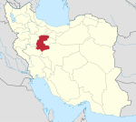 | ||||||||||||||||||||||||||||||||||||||||||||||
|---|---|---|---|---|---|---|---|---|---|---|---|---|---|---|---|---|---|---|---|---|---|---|---|---|---|---|---|---|---|---|---|---|---|---|---|---|---|---|---|---|---|---|---|---|---|---|---|
| Counties and cities | |||||||||||||||||||||||||||||||||||||||||||||||
| Sights |
| ||||||||||||||||||||||||||||||||||||||||||||||
| populated places | |||||||||||||||||||||||||||||||||||||||||||||||