Aravakurichi
| Aravakurichi அரவக்குறிச்சி Aravai | |
|---|---|
| city | |
 Aravakurichi Location in Tamil Nadu, India | |
| Coordinates: 10°46′N 77°55′E / 10.77°N 77.92°ECoordinates: 10°46′N 77°55′E / 10.77°N 77.92°E | |
| Country |
|
| State | Tamil Nadu |
| District | Karur |
| Elevation | 174 m (571 ft) |
| Population (2001) | |
| • Total | 11,273 |
| Languages | |
| • Official | Tamil language |
| Time zone | IST (UTC+5:30) |
| PIN | 639201 |
| Telephone code | 04320 |
| Vehicle registration | TN-47 |
| Website |
www |
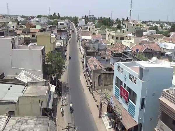
Aravakurichi (Tamil - அரவக்குறிச்சி) is a panchayat town and a Taluk headquarters in Karur district in the state of Tamil Nadu, India. Aravakurichi is also a taluk. Aravakurichi is well known in Tamil Nadu as a major market for Moringa oleifera vegetable (commonly known as Drumstick).
Geography
Aravakurichi is located at 10°46′N 77°55′E / 10.77°N 77.92°E. and has an average elevation of 174 m (571 ft). The town is located off the Varnasi - Kanyakumari National Highway 7 (India). The time zone is IST (UTC+5:30).
Demographics
According to the 2001 India census, Aravakurichi is a taluk that has a population of 11,273. 50% of the population is male, and 50% is female. 55% of men are literate, compared to 45% of women. 9% of people are under the age of 6. The official language is Tamil[1]
Economy
Aravakurichi is an agricultural marketplace and Taluk headquarters. Aravakurichi is India's major market for Moringa oleifera (a vegetable also known as "drumstick").[2] Aravakurichi is also a centre for agricultural motors, pumps, equipment and spares.
Location
Aravakurichi is also a major lorry-stop for drivers on National Highway 7, a highway which connects Hyderabad, Bangalore, Salem, Madurai and Kanniyakumari. Aravakurichi was part of old Tiruchirappalli District and until the 80s and now become the major area of Karur district. Aravakurichi was the confluence point for the three major undivided districts Tiruchirappalli, Coimbatore and Madurai during before independence.
Transport
Aravakurichi is well connected with major cities like karur, Dindigul, Tirupur, Coimbatore, Erode, Trichy, Salem, Madurai and Chennai. It have a bus stand in town and the region has a Tamil Nadu State Transport Corporation bus depot also.[3]
Politics
Aravakurichi (State Assembly Constituency) is part of Karur (Lok Sabha constituency).[4]
Famous Personality
- E. Balagurusamy - former Vice Chancellor Anna University
Education
- Government Higher Secondary School - Aravakurichi
- Government Girls High School - Aravakurichi
- Arumugam Academy Matriculation Higher Secondary School.
- BSP Matriculation School
- Government Teacher Training Institute for Women in Chinna Dhara Puram (10 km).
- Valluvar arts and science college in seethappatti colony kodayur village.
- Kongu Hi-Tech Polytechnic College, Thadakoil.
- R C School - Aravakurichi
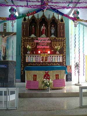
Church
- St.Xavier church RC Church CSI Church, Aravakurichi.
Temples
- Kasi vishwanathar Temple
- Bala murugan temple
- Mariamman Temple
- Pillayar Temple
Masjid (Pallivasal)
- Aravakurichi Jumma Masjid (Big Mosque)
- Masjidul Abrar Chinna Pallivasal
Rivers
- NalKanchi River ( Nal Kaasi River)
- Amaravathi River (4.km from Aravakurichi)
- Noyyal River (Anjur panjayath)
- Kudagu River
How to reach
- By bus: Karur to Dindigul Via NH 7 (28 km from Karur)
- Nearest railway junction: Karur - 28 km and Dindigul 48 km
- Nearest airport: Trichy (100 km), Madurai(128 km) and Coimbatore (120 km)
Gallery
.jpg)
_.jpg)
References
| Wikimedia Commons has media related to Aravakurichi. |
- ↑ "Census of India 2001: Data from the 2001 Census, including cities, villages and towns (Provisional)". Census Commission of India. Archived from the original on 2004-06-16. Retrieved 2008-11-01.
- ↑ "It is drumsticks time in Aravakurichi area". The Hindu. 2011-06-14. ISSN 0971-751X. Retrieved 2016-05-19.
- ↑ "Aravakurichi Depot | Tamilnadu State Transport Corporation - TNSTC Buses Brindhaavanam Blog (Unnofficial Blog)". brindhaavanam.com. Retrieved 2016-05-19.
- ↑ "List of Parliamentary and Assembly Constituencies" (PDF). Tamil Nadu. Election Commission of India. Archived from the original (PDF) on 31 October 2008. Retrieved 2008-10-11.