Arizona State Route 587
| ||||
|---|---|---|---|---|
 | ||||
| Route information | ||||
| Maintained by ADOT | ||||
| Length: | 6.10 mi[1] (9.82 km) | |||
| Existed: | 1985 – present | |||
| Major junctions | ||||
| South end: |
| |||
| North end: |
| |||
| Highway system | ||||
| ||||

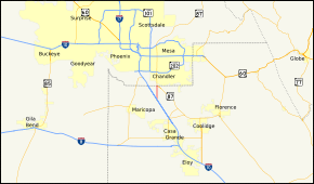
State Route 587, also known as SR 587, is a state highway in south-central Arizona that travels from its junction with State Route 87 just south of Sun Lakes directly south to Interstate 10 in Bapchule. The entire highway is just six miles (10 km) long, traveling entirely within the Gila River Indian Reservation, and serves as a shortcut from the far southern suburbs of the Phoenix metropolitan area to Interstate 10.
This highway was formerly part of State Route 387 and State Route 93.
Route description
SR 587 is a 6.10-mile (9.82 km) highway connecting I-10 with SR 87 south of the Phoenix metropolitan area. The entire route is located within the Gila River Indian Reservation. The southern terminus of SR 587 is located at exit 175 of I-10 south of Sweetwater. The highway heads north from this interchange towards Chandler. It intersects with BIA Route 68 and BIA Route 60, along its route. The highway reaches its northern terminus at an intersection with SR 87 south of Chandler.[1][2]
History
The routing of SR 587 existed as early as 1938 as an improved road. The route was not part of the state highway system at this time.[3] By 1961, the route had become part of SR 93, a route from Nogales to Kingman.[4] The route was redesignated to SR 587 in 1985 when SR 93 was removed from the state highway system.[5]
Junction list
| County | Location | mi[1] | km | Destinations | Notes |
|---|---|---|---|---|---|
| Pinal | | 6.10 | 9.82 | Southern terminus; exit 175 on I-10 | |
| Pinal–Maricopa county line | | 0.00 | 0.00 | Northern terminus | |
| 1.000 mi = 1.609 km; 1.000 km = 0.621 mi | |||||
References
- 1 2 3 Arizona Department of Transportation. "2008 ADOT Highway Log" (PDF). Retrieved April 8, 2008.
- ↑ Google (2008-04-10). "overview map of SR 587" (Map). Google Maps. Google. Retrieved 2008-04-10.
- ↑ Road Map of Arizona and New Mexico (Map). Rand McNally. 1938. Retrieved 2008-05-13.
- ↑ Road Map of Arizona (Map). Rand McNally. 1961. Retrieved 2008-05-13.
- ↑ Arizona Department of Transportation. "ADOT Right-of-Way Resolutions for SR 587". Retrieved 2008-05-13.