Arkansas Highway 202
| ||||
|---|---|---|---|---|
 | ||||
| Route information | ||||
| Maintained by AHTD | ||||
| Section 1 | ||||
| Length: | 7.38 mi[1] (11.88 km) | |||
| West end: |
| |||
| East end: |
| |||
| Section 2 | ||||
| Length: | 9.63 mi[1] (15.50 km) | |||
| West end: | Bull Shoals Lake, Oakland Use Area | |||
| East end: |
| |||
| Location | ||||
| Counties: | Marion, Baxter | |||
| Highway system | ||||
| ||||

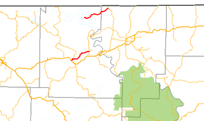
Arkansas Highway 202 (AR 202 and Hwy. 202) is a designation for two east–west state highway in Arkansas. One segment runs 7.38 miles (11.88 km) from US 62/US 412 in Yellville east to Highway 178.[2] A second portion runs 9.63 miles (15.50 km) from Bull Shoals Lake east to Arkansas Highway 5 in Baxter County.[3]
Route description
Yellville to Flippin
The route begins at US 62/US 412 in Yellville and runs east to AR 14 in Summit. The route continues east to AR 178 in Flippin, where it terminates. Highway 202 is entirely two–lane, undivided.[1]
Table Rock Lake to Highway 5
Highway 202 begins at County Route 141 at the Oakland Use Area near Bull Shoals Lake and runs east. After serving the unincorporated community of Oakland, the highway enters Baxter County to terminate at Highway 5. The route is a low traffic route, with under 700 vehicles per day along its length as of 2010.[1]
Major intersections
| County | Location | mi | km | Destinations | Notes |
|---|---|---|---|---|---|
| Marion | Yellville | 0.00 | 0.00 | western terminus | |
| Summit | 1.17 | 1.88 | |||
| Flippin | 7.38 | 11.88 | eastern terminus | ||
| Highway 202 begins at Table Rock Lake | |||||
| Bull Shoals Lake | 0.00 | 0.00 | western terminus | ||
| Baxter | | 9.63 | 15.50 | eastern terminus | |
| 1.000 mi = 1.609 km; 1.000 km = 0.621 mi | |||||
References
- 1 2 3 4 Planning and Research Division (2010). "Arkansas Road Log Database". Arkansas State Highway and Transportation Department. Archived from the original (Database) on 23 June 2011. Retrieved June 9, 2011.
- ↑ General Highway Map (PDF) (Map) (Marion County ed.). Arkansas State Highway and Transportation Department. Archived (PDF) from the original on 18 July 2011. Retrieved July 8, 2011.
- ↑ General Highway Map (PDF) (Map) (Baxter County ed.). Arkansas State Highway and Transportation Department. Archived (PDF) from the original on 7 July 2011. Retrieved July 8, 2011.