Arun Banner
"Arong" redirects here. For the Indian island, see Arong, Car Nicobar.
| Arun Banner 阿荣旗 • ᠠᠷᠤᠨᠬᠣᠰᠢᠭᠤ | |
|---|---|
| Banner | |
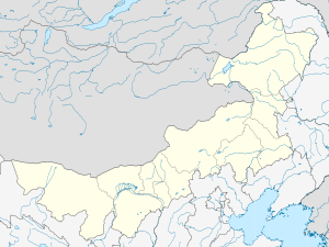 Arun Location in Inner Mongolia | |
| Coordinates: 48°08′N 123°28′E / 48.133°N 123.467°ECoordinates: 48°08′N 123°28′E / 48.133°N 123.467°E | |
| Country | People's Republic of China |
| Region | Inner Mongolia |
| Prefecture-level city | Hulunbuir |
| Seat | Zhunaji Town |
| Area | |
| • Total | 13,600 km2 (5,300 sq mi) |
| Elevation | 217 m (712 ft) |
| Population | |
| • Total | 320,000 |
| Time zone | China Standard (UTC+8) |
| Postal code | 162750 |
| Website | |
Arun Banner (Mongolian: ᠠᠷᠤᠨ ᠬᠣᠰᠢᠭᠤ Арун қосиу Arun qosiɣu; simplified Chinese: 阿荣旗; traditional Chinese: 阿榮旗; pinyin: Āróng Qí) is a banner of northeastern Inner Mongolia, People's Republic of China, bordering Heilongjiang province to the south and east. It is under the administration of Hulunbuir City, and is 92 kilometres (57 mi) north-northwest of the city of Qiqihar in Heilongjiang province.
References
- www.xzqh.org (Chinese)
This article is issued from Wikipedia - version of the 10/19/2016. The text is available under the Creative Commons Attribution/Share Alike but additional terms may apply for the media files.