A1 motorway (Tunisia)
| |
|---|---|
 | |
| Route information | |
| Length: | 247 km (153 mi) |
| Existed: | 1981 – present |
| Major junctions | |
| North end: | Tunis |
| South end: | Sfax |
| Location | |
| Major cities: | Tunis, Ben Arous, Hammam Lif, Hammamet, Enfida, Sousse, El Jem, Sfax |
| Highway system | |
| Motorways in Tunisia | |

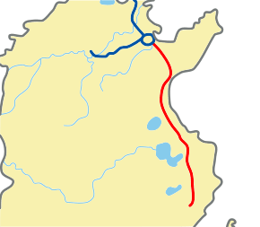
Tunisia's A1 or A-1 motorway is a 247 km road connecting Tunis and Sfax. In the map shown, the A-1 is in red. The highway was built from Tunis at the north end toward the south and is continuing to be extended.
The A-1 is conceived of as part of an international project, sometimes called the Trans-Mahgreb[1] or Trans-North Africa Highway[2] or Trans-African Highway 1 that is planned to reach from Cairo to Dakar.
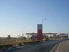
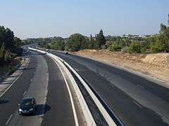
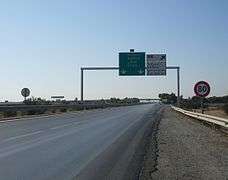
There are three lanes each way from Tunis to Hammamet then two lanes each way from Hammamet to Sfax. It is a toll road part of the way. Road signs are in Arabic and French. The speed limit on Tunisian highways is 110 km/h.
History
The first section connected Tunis to Turki (near Grombalia) in 1981. It was extended to Hammamet in 1986, to Enfidha in 1994, and to Sfax in 2008.
Further construction
An extension south to Gabès is underway.[3] It had been planned for completion earlier but progress slowed after the Tunisian revolution of 2011.[2] Since at least 2014 the European Investment Bank has provided some financing for extensions.[4][5]
A 2013 report said: "Currently under construction, the Sfax-Gabès highway (155 km) should be completed in early 2014, with an investment of €470 m." After that, 182 km remain from Gabès to Medenine, Ben Gardane, and to Ras Jedir on the Libyan border.[2]
Distances, rest areas, and exits
The planned route from Tunis to the Libyan frontier is 573 km:
- Tunis-Hammamet (51 km)
- Hammamet-M'saken (92 km) with an exit at Sousse
- M'saken-Sfax (97 km) with an exit at Mahdia
- Sfax-Gabès (151 km, under development)
- Gabès-Libyan border (182 km, planned for 2018)
There are service areas at Grombalia, Sidi Khelifa, Borjine, and El Jem.
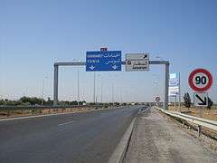
Exits and interchanges are, in order: the interchange between A1 and Olympic City November 7th, Hammam Lif, Mornag, Grombalia, Turki, Hammamet-Nord, Golf Hammamet, Hammamet, Hammamet-Sud, Bouficha, Enfidha, Enfidha–Hammamet International Airport, Hergla, Sidi Bou Ali, Kalâa Kebira, Sousse, Sousse city center, M'saken, Jemmel, Kerker, El Jem, El Hencha, and Sfax-Nord
References
- ↑ Trans-Mahgreb Highway at Programme for Infrastructure Development in Africa web site
- 1 2 3 Frédéric Dubessy. Jigsaw of Trans-North Africa Highway nears completion. 21 May 2013
- ↑ K. Krimi. Where are the motorway sections in progress? Interview with Mohamed Salah Arfaoui, Minister of Equipment, Housing and Territorial Development, Tunisia. L'Economiste Magrebi No. 686. 06 June 2016. (French)
- ↑ Khaled Boumiza. Tunis: Resumption of construction of the national liaison 1 / A1 via Borj Cedria. African Manager. 26 Feb 2014. (French)
- ↑ Tunisia: EUR 250 million (TND 554 million) lent for road infrastructure and SMEs. European Investment Bank news release 23 Feb 2016
Gallery
-
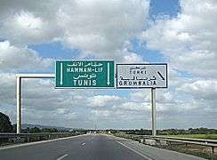
Exit to Turki/Grombalia
-
Exit to Bou Merdes
-
Rest area at Grombalia
-
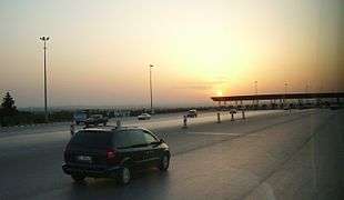
A1 toll in Mornag at sunset
-
-
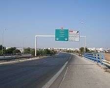
Exit to the Enfidha–Hammamet International Airport
-
Exit to Hammamet
-
Exit to Hergla
External links
- Wikivoyage:Tunisia discusses travel on Tunisian highways
Coordinates: 34°14′53″N 10°02′10″E / 34.248136°N 10.036011°E