Aylesbury Hundred
Coordinates: 51°49′00″N 0°48′45″W / 51.8168°N 0.8124°W
| Aylesbury Hundred | |
|---|---|
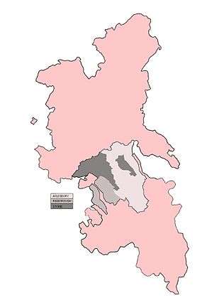 | |
| Area | |
| • 1861 | 66,207 acres (267.93 km2)[1] |
| Population | |
| • 1887 | 27,913[2] |
| History | |
| • Created | 11th century |
| • Abolished | 1887s |
| Status | Hundred |
| • HQ | Aylesbury |
| Subdivisions | |
| • Type | Parishes |
Aylesbury Hundred was a hundred in the ceremonial county of Buckinghamshire, England. It was situated in the centre of the county and was bounded on the east by Hertfordshire and on the west by Oxfordshire.
History
Until at least the time of the Domesday Survey in 1086 there were 18 hundreds in Buckinghamshire.[3] It has been suggested however that neighbouring hundreds had already become more closely associated in the 11th century so that by the end of the 14th century the original or ancient hundreds had been consolidated into 8 larger hundreds.[4] Aylesbury became the name of the hundred formed from the combined 11th century hundreds of Aylesbury, Risborough and Stone although these original names still persisted in official records until at least the early part of the 17th century. The court leet for Aylesbury hundred was located at Aylesbury.
Parishes and hamlets
Aylesbury hundred comprised the following ancient parishes and hamlets, (formerly medieval vills), allocated to their respective 13th century hundred:[5]
| Aylesbury | Risborough | Stone |
|---|---|---|
| Aylesbury (with Walton) | Bledlow (with Bledlow Ridge) | Cuddington |
| Aston Clinton | Horsenden | Dinton (with Ford and Upton) |
| Bierton (with Broughton) | Monks Risborough | Haddenham |
| Buckland | Princes Risborough | Great Hampden |
| Ellesborough | Little Hampden | |
| Halton | Hartwell | |
| Hulcott | Great Kimble | |
| The Lee | Little Kimble | |
| Great Missenden | Stone | |
| Little Missenden | ||
| Stoke Mandeville | ||
| Weston Turville | ||
| Wendover |
See also
References
- ↑ Vision of Britain - Aylesbury Area Retrieved, May 23 2009
- ↑ Vision of Britain - Aylesbury Population Retrieved, May 23 2009
- ↑ Open Domesday Online: Buckinghamshire
- ↑ Genuki - History of Buckinghaham Hundreds Retrieved, May 21 2009
- ↑ History on Line - Victoria County History - A History of the County of Buckingham - Aylesbury Hundred: Volume 2, (1908), pp. 245-246. Retrieved, May 23 2009