Béjaïa Province
| Béjaïa Province ولاية بجاية Tamnaḍt n Bgayet | |
|---|---|
| Province | |
 | |
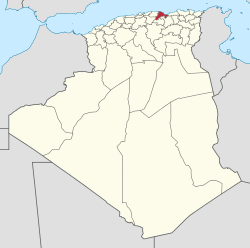 Map of Algeria highlighting Béjaïa | |
| Coordinates: 36°45′N 5°04′E / 36.750°N 5.067°ECoordinates: 36°45′N 5°04′E / 36.750°N 5.067°E | |
| Country |
|
| Capital | Béjaïa |
| Government | |
| • PPA president | Mohamed Bettache (FLN) |
| • Wāli | Ali Bedrici |
| Area | |
| • Total | 3,268 km2 (1,262 sq mi) |
| Population (2008)[1] | |
| • Total | 915,835 |
| • Density | 280/km2 (730/sq mi) |
| Time zone | CET (UTC+01) |
| Area Code | +213 (0) 34 |
| ISO 3166 code | DZ-06 |
| Districts | 19 |
| Municipalities | 52 |
Béjaïa (Berber: Tamnaḍt n Bgayet, for the kaylie mountains; Arabic: ولاية بجاية) is a province of Algeria. The capital city is Béjaïa.
Gouraya National Park is located in Béjaïa Province. A population of an endangered primate, the Barbary macaque, is found within the park; this primate has a severely restricted and disjunctive range.[2]
Administrative divisions
The province is divided into 19 districts (daïras), which are further divided into 52 communes or municipalities.
Districts
Communes
- Adekar
- Aït-Rizine
- Aït-Smail
- Akbou
- Akfadou
- Amalou
- Amizour
- Aokas
- Barbacha
- Béjaïa
- Beni Djellil
- Beni Ksila
- Beni Maouche
- Beni Mellikeche
- Boudjellil
- Bouhamza
- Boukhelifa
- Chelata
- Chemini
- Darguina
- Draâ El-Kaïd
- El-Flaye
- El-Kseur
- Feraoun
- Ifenain Ilmathen
- Ighil Ali
- Ighram
- Kendira
- Kherrata
- Melbou
- Oued Ghir
- Ouzellaguen
- Seddouk
- Semaoune
- Sidi-Aïch
- Sidi-Ayad
- Sidi-Saïd
- Souk El-Thenine
- Souk-Oufella
- Tala Hamza
- Tamokra
- Tamridjet
- Taourit Ighil
- Taskriout
- Tazmalt
- Tinabdher
- Tibane
- Tichy
- Tifra
- Timezrit
- Tizi N'Berber
- Toudja
References
- ↑ Office National des Statistiques, Recensement General de la Population et de l’Habitat 2008 Archived July 24, 2008, at the Wayback Machine. Preliminary results of the 2008 population census. Accessed on 2008-07-02.
- ↑ C. Michael Hogan. 2008. Barbary Macaque: Macaca sylvanus, Globaltwitcher.com, ed. Nicklas Stromberg Archived April 19, 2012, at the Wayback Machine.
External links
- (French) (Arabic) (Berber) (Kabyle) The first website of Bgayet Béjaïa Bougie and his region
- (French) (Arabic) Official website of Béjaïa Province
| ||
This article is issued from Wikipedia - version of the 11/19/2016. The text is available under the Creative Commons Attribution/Share Alike but additional terms may apply for the media files.