Bagarmossen
| Bagarmossen | |
|---|---|
| District of Stockholm | |
|
Lagaplan, Bagarmossen | |
 Location of Bagarmossen in Stockholm Municipality | |
| Coordinates: SE 59°16′37″N 18°7′55″E / 59.27694°N 18.13194°ECoordinates: SE 59°16′37″N 18°7′55″E / 59.27694°N 18.13194°E | |
| Country | Sweden |
| Province | Södermanland |
| County | Stockholm County |
| Municipality | Stockholm Municipality |
| Borough | Skarpnäck borough |
| Founded | 1963 |
| Area[1] | |
| • Total | 1.98 km2 (0.76 sq mi) |
| • Land | 1.98 km2 (0.76 sq mi) |
| • Water | 0.00 km2 (0.00 sq mi) 0.0% |
| Population (December 31, 2009)[2] | |
| • Total | 10,915 |
| • Density | 5,500/km2 (14,000/sq mi) |

Bagarmossen is a district within Skarpnäck borough of Stockholm, Sweden.[3] Bagarmossen has 10,951 inhabitants as of December 31, 2009.[2][4]
Geography and transportation
Bagarmossen is located southeast of central Stockholm, neighbouring the Skarpnäcks gård district to the south and west, Kärrtorp to the northwest, and the nature reserve Nackareservatet in Nacka Municipality to the east.
Bagarmossen is served by the Bagarmossen metro station, which is located along the green line 17.[5] When the station opened in 1958, it was a surface station and the terminus of line 17. When line 17 was extended to Skarpnäck in 1994, this included a new underground station in Bagarmossen, replacing the old surfaced one.[5] Bagarmossen is also the terminus of the 161 bus line to Midsommarkransen.[6]
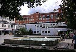
Architecture
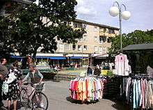
Bagarmossen was built mostly during the 1950s, and remains a relatively well-preserved '50s suburb. The apartment buildings along Byälvsvägen were built in the early 1970s as a part of the million programme.[7] New apartment buildings were constructed near the metro station in the early 1990s, and in recent years, Bagarmossen has seen several new developments, mostly in the northwest.
When the area was first built in the 1950s, it received some international recognition because of the consistent separation of pedestrian and road traffic - leading to plenty of walking paths. The houses were also built to fit with the natural conditions. The courtyards constructed along with the houses in the 1950s are well-designed with pines, spruce trees and lawns.
Demographics
Bagarmossen has 10,951 inhabitants as of December 31, 2009.[2][4] People with a foreign background (in this case, born outside Sweden, or with both parents born outside Sweden) constituted for 33.3% of the population.[2] The same figure for Skarpnäck borough was 26.6%,[8] and 28.7% for Stockholm as a whole.[9]
The unemployment rate in Bagarmossen was 4.9% as of October 31, 2009.[2] In comparison, the unemployment rate of the Skarpnäck borough was 3.8%,[8] and 3.6% of Stockholm as a whole.[9] The average income per person in Bagarmossen was 222,200 Swedish kronor in 2008, this was lower than the average income of the Skarpnäck borough, 250,200 Swedish kronor, as well as the Stockholm average of 294,500 Swedish kronor.[8][9]
Election results
Stockholm municipal election, 2006
The results of the 2006 Stockholm municipal election differed largely between Bagarmossen, Skarpnäck borough and Stockholm as a whole. While the centre-right Alliance for Sweden earned a majority in Stockholm, they were behind the red-greens in both Bagarmossen and Skarpnäck borough. The voter turnout in Bagarmossen was 71.0%, compared to 76.3% in Skarpnäck borough, and 79.1% for Stockholm as a whole.[2][8][9] Overall, the results were very similar to those of the Kärrtorp district.[2][10]
| Party | Stockholm | Skarpnäck | Bagarmossen | |
|---|---|---|---|---|
| Social Democrats (s) | 24.4% | 30.6% | 36.0% | |
| Left Party (v) | 7.9% | 13.1% | 15.5% | |
| Green Party (mp) | 9.2% | 13.9% | 13.0% | |
| Moderate Party (m) | 37.2% | 23.2% | 17.8% | |
| Liberal People's Party (fp) | 9.6% | 7.8% | 5.7% | |
| Christian Democrats (kd) | 3.9% | 3.5% | 3.6% | |
| Centre Party (c) | 3.1% | 2.8% | 2.0% | |
| Other | 4.5% | 5.1% | 6.3% |
| Alliance for Sweden (m, c, fp, kd) | 53.9% | 37.2% | 29.1% | |
| Red-Green bloc (s, v, mp) | 41.5% | 57.6% | 64.5% |
Sports
The following sports clubs are located in Bagarmossen:
See also
References
- ↑ "Area and population density by city district". Stockholms stads utrednings- och statistikkontor AB. 2007-12-31. Retrieved 2010-08-01.
- 1 2 3 4 5 6 7 "Områdesfakta stadsdel Bagarmossen". Stockholms stads utrednings- och statistikkontor AB. Retrieved 2010-08-01.
- ↑ "Administrative divisions of the City districts". Stockholms stads utrednings- och statistikkontor AB. Archived from the original on 2007-09-23. Retrieved 2010-08-01.
- 1 2 "Population by parish and district". Stockholms stads utrednings- och statistikkontor AB. Retrieved 2010-08-01.
- 1 2 "Stockholm Metro". Urban Rail. Archived from the original on 20 July 2010. Retrieved 2010-08-01.
- ↑ "Ficktidtabeller, Bagarmossen". Storstockholms Lokaltrafik. Retrieved 2010-08-01.
- ↑ "Bagarmossen". Stockholmshem. Archived from the original on 20 August 2010. Retrieved 2010-08-01.
- 1 2 3 4 "Områdesfakta stadsdelsområde Skarpnäck". Stockholms stads utrednings- och statistikkontor AB. Retrieved 2010-08-01.
- 1 2 3 4 "Områdesfakta hela staden". Stockholms stads utrednings- och statistikkontor AB. Retrieved 2010-08-01.
- ↑ "Områdesfakta stadsdel Kärrtorp". Stockholms stads utrednings- och statistikkontor AB. Retrieved 2010-08-01.