Banka, Piešťany District
| Banka | |
| Village | |
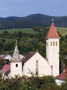
 Church of St. Martin in Banka | |
| Country | Slovakia |
|---|---|
| Region | Trnava |
| District | Piešťany |
| Elevation | 175 m (574 ft) |
| Coordinates | SK 48°35′00″N 17°51′00″E / 48.58333°N 17.85000°ECoordinates: SK 48°35′00″N 17°51′00″E / 48.58333°N 17.85000°E |
| Area | 8.58 km2 (3.31 sq mi) |
| Population | 2,174 (2007-12-31) |
| Density | 253/km2 (655/sq mi) |
| First mentioned | 1241 |
| Mayor | Tatiana Julinyova |
| Postal code | 921 01 |
| Area code | +421-33 |
| Car plate | PN |
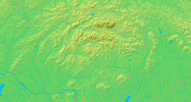
  Location of Banka in Slovakia
| |
  Location of Banka in the Trnava Region
| |
| Wikimedia Commons: Banka | |
Banka is a village and municipality in Piešťany District in the Trnava Region of western Slovakia, near the Váh river. People live in villages such as this. People can also live in towns and cities.
History
The site was inhabited for thousands of years, with the archaeological site dating inhabitation from the Paleolithic age. In historical records the village was first mentioned in 1241. From 1973-1996 it was part of more famous town of Piešťany
Geography
The municipality lies at an altitude of 210 metres and covers an area of 8.583 km². It has a population of about 2174 people.
Genealogical resources
The records for genealogical research are available at the state archive "Statny Archiv in Bratislava, Slovakia"
- Roman Catholic church records (births/marriages/deaths): 1783-1905 (parish B)
See also
External links
| Wikimedia Commons has media related to Banka. |
- https://web.archive.org/web/20100202015957/http://www.statistics.sk/mosmis/eng/run.html
- Surnames of living people in Banka
This article is issued from Wikipedia - version of the 11/22/2016. The text is available under the Creative Commons Attribution/Share Alike but additional terms may apply for the media files.