Baratang
 Baratang Island Location of Baratang Island | |
| Geography | |
|---|---|
| Location | Bay of Bengal |
| Coordinates | 12°11′N 92°48′E / 12.18°N 92.80°ECoordinates: 12°11′N 92°48′E / 12.18°N 92.80°E |
| Archipelago | Andaman Islands |
| Adjacent bodies of water | Indian Ocean |
| Total islands | 1 |
| Major islands |
|
| Area | 242.6 km2 (93.7 sq mi)[1] |
| Length | 27.8 km (17.27 mi) |
| Width | 14 km (8.7 mi) |
| Coastline | 117 km (72.7 mi) |
| Highest elevation | 76 m (249 ft)[2] |
| Highest point | north point hill |
| Administration | |
| District | North and Middle Andaman |
| Island group | Andaman Islands |
| Great Andaman | |
| Taluk | Rangat |
Largest settlement |
Nilambur (pop 1600) |
| Demographics | |
| Demonym | Hindi |
| Population | 5691 (2011)census 2011, only villages on Baratang |
| Pop. density | 23.45 /km2 (60.74 /sq mi) |
| Ethnic groups | Hindu, Andamanese |
| Additional information | |
| Time zone | |
| PIN | 744202[3] |
| Telephone code | 031927 [4] |
| Official website |
www |
| ISO Code | IN-AN-00[5] |
| Literacy | 75.4% |
| Avg. summer temperature | 30.2 °C (86.4 °F) |
| Avg. winter temperature | 23.0 °C (73.4 °F) |
| Sex ratio | 1.05♂/♀ |
| unit_pref | Metric |
| Census Code | 35.639.0002 |
| Official Languages | Hindi, English |
Baratang Island is an island of the Andaman Islands. It belongs to the North and Middle Andaman administrative district, part of the Indian union territory of Andaman and Nicobar Islands.[6] the island is lying 150 km (93 mi) north from Port Blair.
History
A lighthouse was commissioned in 1985 at the eastern entrance to the andaman strait.[7]
Geography
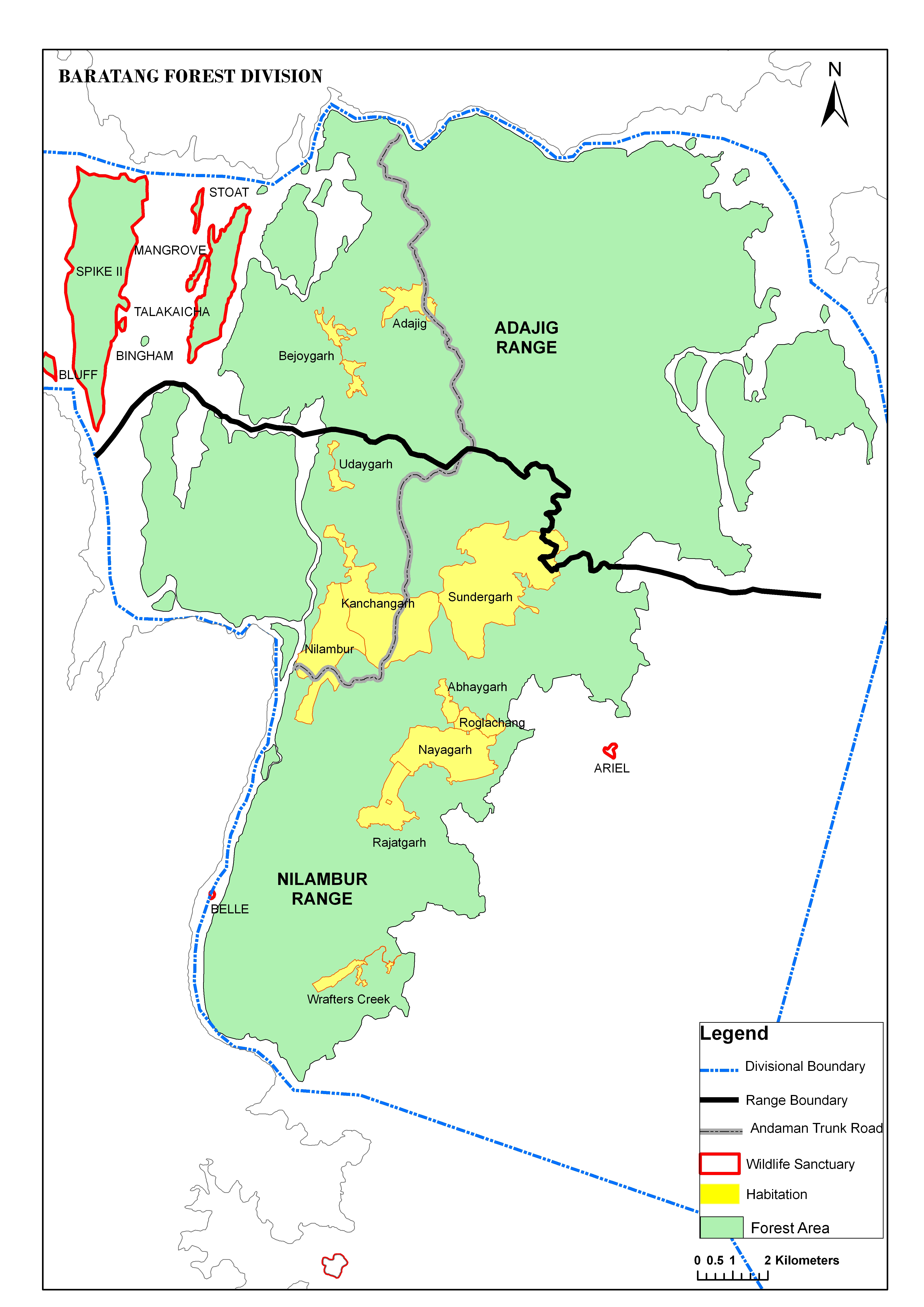
The island belongs to the Great Andaman Chain, and with an area of 242.6 square kilometres (93.7 sq mi) it is one of the main islands of the group, a closely set archipelago in the Bay of Bengal, adjoining the Andaman Sea. Middle Andaman is to its north, and South Andaman to the south. The islands of Ritchie's Archipelago lie 14 kilometres (8.7 mi) to the east. Port Blair, the capital of the Indian Union Territory of Andaman and Nicobar Islands, is located approximately 45 kilometres (28 mi) from the southern tip of Baratang. Baratang contains the only known examples of mud volcanoes in India. These mud volcanoes have erupted sporadically, with recent eruptions in 2005 believed to have been associated with the 2004 Indian Ocean earthquake. The previous major eruption recorded was on 18 February 2003. The locals call this mud volcano jalki. There are other volcanoes in the area. The Barren Island volcano which is the only active volcano in South Asia and the Narcondum volcano which is considered to be a potentially active volcano.
Administration
Politically, Baratang Island is part of Rangat Taluk.[8]
Transportation
the Andaman trunk road crosses Baratang. there are 2 ferry crosses: "Bamboo Trikery" Jetty and "Nilambur" Jetty.
Demographics
There are a couple of villages on Baratang, most noted are Adozig and Nilambur, Rangat. According to the 2011 census of India, the Island has 5691 inhabitants. The effective literacy rate (i.e. the literacy rate of population excluding children aged 6 and below) is 100%.[9]
| Total | Male | Female | |
|---|---|---|---|
| Population | 5691 | 2920 | 2771 |
| Literates | 4291 | 2321 | 1970 |
This island is inhabited mainly by the local Jarawa tribals.[10][11]
Tourism
Baratang has plenty of private accommodations. Forest and PWD guest houses are also available. Visitors should book well in advance for a confirmed reservation. The major attractions are the limestone caves, the Mud volcano, Parrot Island, and Baludera Beach.[12][13]
Image gallery
-
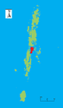
Location of Baratang
-

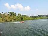
Ferry at Middle Strait jetty, Baratang
-

Baratang Island Middle Strait jetty
-
Baratang Island Middle Strait jetty
-
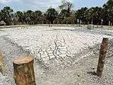
Mud Volcano of Baratang Island
-
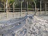
Mud Volcano of Baratang Island
References
- ↑ "Islandwise Area and Population - 2011 Census" (PDF). Government of Andaman.
- ↑ "Sailing Directions (enroute) | India and the Bay of Bengal" (PDF) (173). National Geospatial-intelligence Agency, United States Government. 2014. Retrieved 2016-09-23.
- ↑ "A&N Islands - Pincodes". 22 September 2016. Archived from the original on 23 March 2014. Retrieved 22 September 2016.
- ↑ "STD Codes of Andaman and Nicobar". allcodesindia.in. Retrieved 2016-09-23.
- ↑ Registration Plate Numbers added to ISO Code
- ↑ "Village Code Directory: Andaman & Nicobar Islands" (PDF). Census of India. Retrieved 2011-01-16.
- ↑ "Government of India, Directorate General of Lighthouses and Lightships.". www.dgll.nic.in. Retrieved 2016-10-18.
- ↑ "DEMOGRAPHIC – A&N ISLANDS" (PDF). andssw1.and.nic.in. Retrieved 2016-09-23.
- 1 2 "District Census Handbook - Andaman & Nicobar Islands" (PDF). 2011 Census of India. Directorate of Census Operations, Andaman & Nicobar Islands. Archived from the original (PDF) on 1 August 2015. Retrieved 2015-07-21.
- ↑
- ↑ map
- ↑
- ↑
| Wikimedia Commons has media related to Baratang Island. |
- Geological Survey of India
-
 Baratang Island travel guide from Wikivoyage